
We had seen enough pictures and had enough people recommend Tahquamenon Falls to know that it was going to be a "must see" for us. The recommendations had been mostly written recommendations so we weren't quite sure of the proper pronunciation. We had pronounced it many different ways, but none of them were correct. Tahquamenon rhymes with phenomenon. No matter how you pronounce it, it's well worth seeing!
The drive to the falls was close to an hour and a half, but as with all the drives we've made in and around the Upper Peninsula, it was just as much fun and scenic getting there as it was once we arrived. Tahquamenon Falls is actually two separate falls, the upper falls and the lower falls. There is a four mile trail that connects the two falls, however, it is listed as a "difficult" hike. Like most people, we opted to drive between the two.

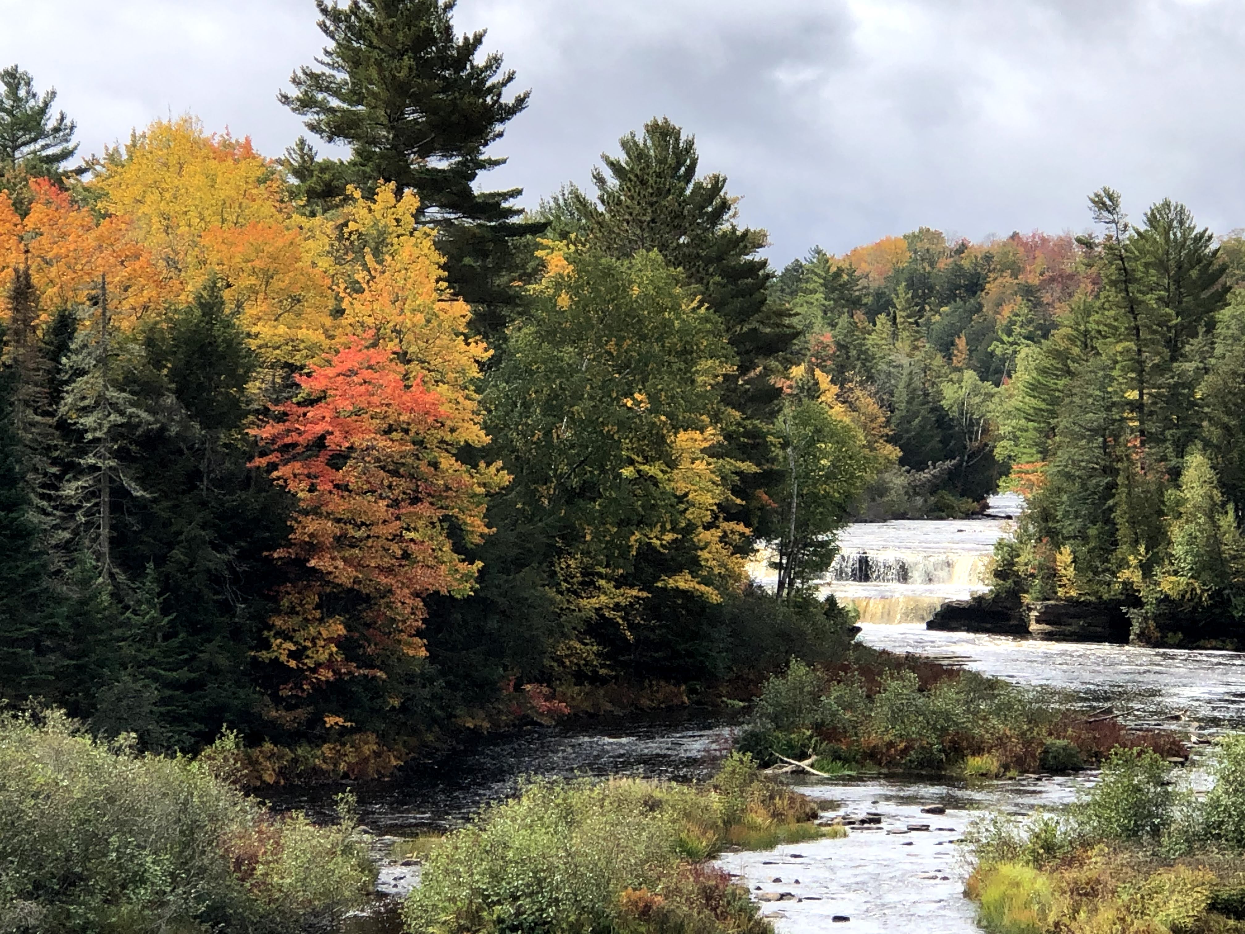
Another view of the Upper Falls
At more than 200 feet wide and with a drop of close to 50 feet, the upper falls is the larger of the two. The lower falls is actually a series of five smaller falls that flow around a small island. The water, which during the spring runoff can flow at up to 50,000 gallons per second was flowing at around 3,000 gallons per second on this early fall day. The water which originates upstream in cedar swamps has a brown color to it, as it lands in the basin it produces a white foam. With brown water and white foam, the falls have deservedly earned the nickname "The Root Beer Falls".


Our trip to Tahquamenon Falls was yesterday (Tuesday). Today we were back on a trail in the Pictured Rocks National Lakeshore. Today's hike was part of the Little Beaver Lake Trail. Our version was a little under six miles in length. It was a little muddy in a small section but otherwise a great hike along a trail that is well traveled on the weekends but that was practically deserted on a cloudy, cool and damp Wednesday. The hike included a section along the breezy shore of Lake Superior as well another section along Little Beaver Lake. There's a longer loop version of this trail that encircles the entire lake (Little Beaver Lake not Lake Superior) and is over eleven miles in length, but we're saving it for another day.
Day Hikes In Pictured Rocks National Lakeshore


Little Beaver Lake one more time!