Wednesday, February 28, 2018

Here we snow again!

We've bid adios to Sedona and moved south to the high desert country of Tucson.  It's was a fun six days.  Great scenery, nice hikes, good food and a really good hot tub not far from the room.  We even learned a little bit about the history of Sedona during our time there.  Native Americans first settled that area over 10,000 years ago because there was a spring that served as a year round water source.  The first Anglo pioneers arrived in the 1870's.  In 1902 a gentleman named T.C. Schnebly saw the need for a post office.  He applied and suggested the name Sedona, which coincidently happened to be his wife's name.  Hence, the name of the city and hopefully a happy wife. 
Yesterday we kicked off the day with a little health food, a three pound cinnamon bun from the Red Rocks CafĂ©.  It had been recommended to us by Beth's sister Cindy, and it lived up to it's billing.  We managed to get a little over half of it down.  We enjoyed the rest of it for desert as we watched the pride of Burleson, Texas, Kelly Clarkson on The Voice.  She's pretty darn funny!
 http://www.redrockcafeaz.com/
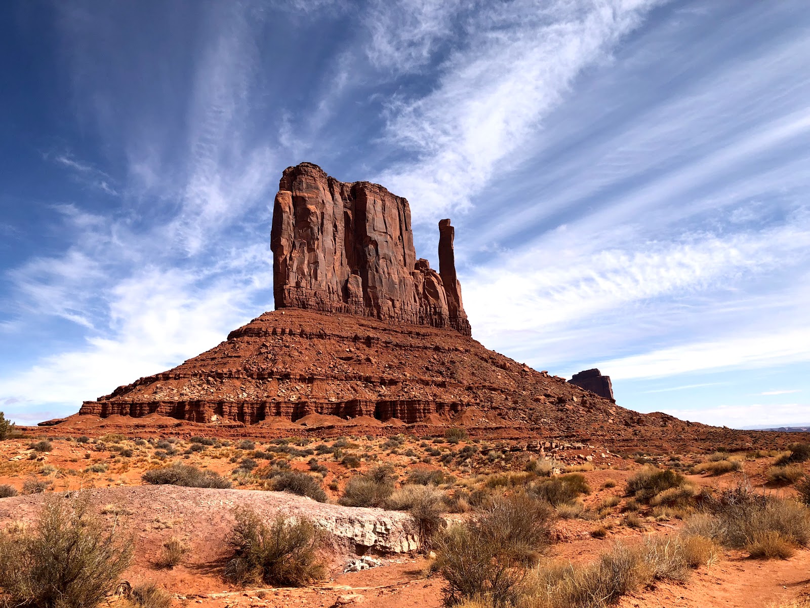
We did try to make up for the indulgence with a really nice two hour hike.  This one was along the "Little Horse and Chapel Trails".  The turnaround point of this out and back trail was the Chapel of the Holy Cross, which is an impressive Roman Catholic chapel built high up in the red rocks overlooking Sedona.  Like the other trails we've selected, these were fairly flat but they offered incredible scenery the whole time.  There's just one thing about these trails and the scenery, they're hard to enjoy at the same time.  The trails are very rocky so you really have to watch your step, every single one of them.  So we, along with all the hikers we see on the trails stop frequently to soak up the incredible scenery.  If you come to Sedona and you plan on hiking make sure you have a pair of good sturdy shoes and keep your eyes on the trail when you're walking!
https://www.gatewaytosedona.com/the-chapel-of-the-holy-cross-sedona-architectural-landmark
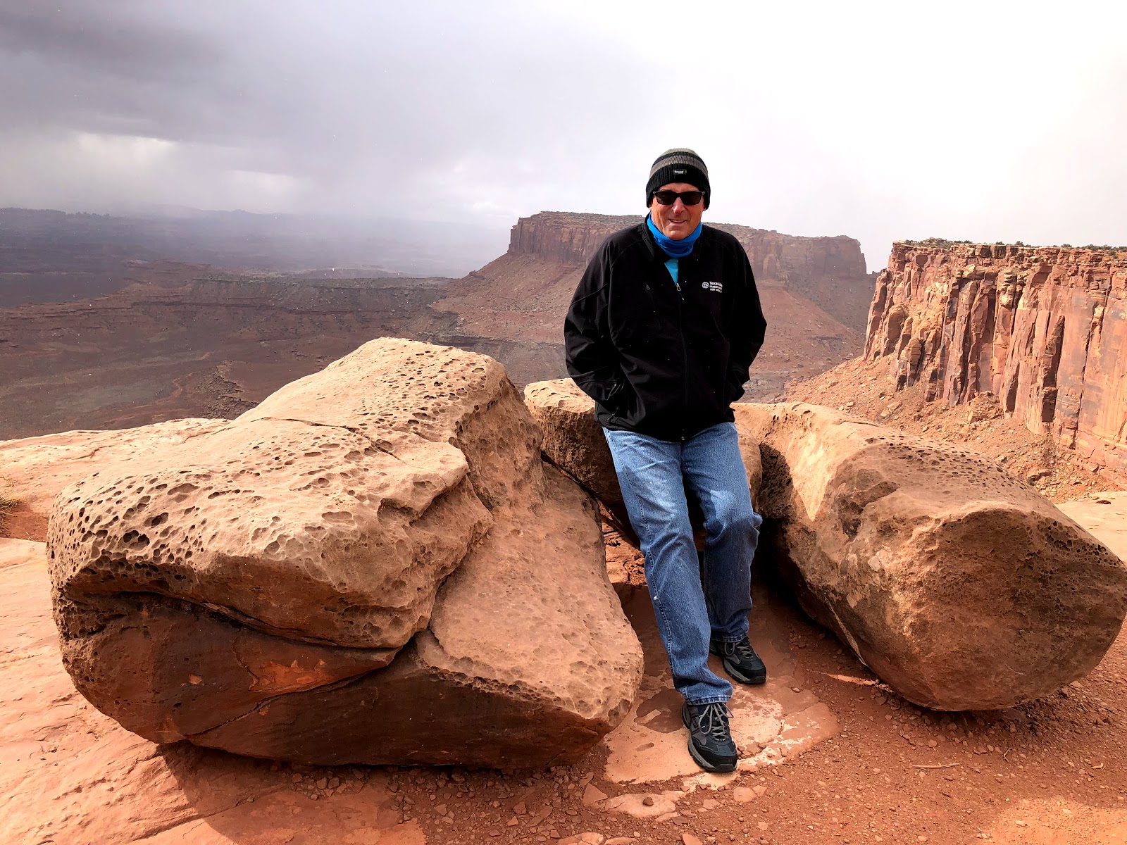
We've had a mixed bag of weather while we've been here.  From a snowy Friday, to cloudless but cool days Saturday through Tuesday.  So here it is Wednesday morning, and "here we snow again".


Three pounds of absolute happiness!

Along the Adobe Jack Trail


The Little Horse Trail


A snowy Sedona send off!


Sunday, February 25, 2018

We're on a trail, just not sure which one!

After a chilly, snowy Friday the weather Gods have smiled on us.  We woke up Saturday to crisp, clear blue skies and calm winds.  By early afternoon the temperature was in the mid 40's so we were off to explore a few of the more than 300 miles of trails in the Sedona area.
We drove a few miles out of Sedona to one of the areas major landmarks, Bell Rock.  It's a beautiful red rock in the shape of, you guessed it, a bell.  There were numerous trails around the rock including one that was supposed to go around the perimeter.  The problem was the numerous trails were not really well marked and they crisscrossed, zig-zagged, intersected, and bisected along the way.  We were never off a trail but also never really sure which one we were on.  We were never really concerned about being lost because we had the massive Bell Rock as a land mark.  But, we ended up not finding the trail that would have taken us around the rock. We made it an out and back trail.  We had great views along the entire hike.  We were also entertained by the "mystical people" along the way.  Apparently if you're so inclined to believe this kind of stuff there are "vortexes" (an area of "high energy") along the trail.  There were a lot of "vortex hunters" out there and you could spot them from quite a ways away.  I guess we never found one because neither of us reported a surge of energy along the hike.  We did find a surge of happiness when we landed in the hot tub after the walk.
https://www.fs.usda.gov/recarea/coconino/recarea/?recid=55230
Earlier today (Sunday) we took advantage of a trail that starts just behind the hotel.  It was called the Girdner Trail and it was a good one.  It was mostly flat but with just enough rolling hills to make it interesting.  There were great views of the Sedona Valley and the Red Rocks in the background.  We did about two hours out and back and appropriately enough rewarded our efforts with another soak in the hot tub afterwards.  As you well know, recovery is very important and hot tubs are a very important part of the recovery process.
https://www.mtbproject.com/trail/4943363/girdner-trail
We drove to the small town of Jerome, which is about 24 miles from Sedona for a late lunch and casual stroll around this small town perched on the side of a mountain. It sits just over a mile in elevation.
Jerome was founded in the 1800's and was once the fourth largest city in what was then known as the "Arizona Territory".  The mainstay of industry for the town was copper mining followed closely by whiskey drinking and prostitution, helping it earn the nickname "the wickedest city in the west".  Today, although the town still has a few watering holes, the mine and the numerous brothels have closed.  They've been replaced by art galleries, wineries, restaurants, and small local shops making it a great place to spend a sunny afternoon. 
http://www.azjerome.com/jerome/
We haven't been in close proximity to a good BBQ joint in a while but we found one in Jerome.  It had a little bit of an unusual name for a BBQ place, "Bobby D's BBQ at the English Kitchen".  Neither Bangers and Mash, Fish and Chips or any other English food was on the menu.  They did offer up some mighty fine BBQ.  The brisket was especially good and could easily hold it's own against some of the top places in Texas.  The history of the restaurant and the unusual name is an entertaining short read that you can get to on the history tab of the link below.  It includes a Chinese restaurateur, prisoners, and an opium den.   Before you go there take a look at some of the pictures of the food on the home page.  I'll bet even if you're vegetarian your mouth will water!
http://www.bobbydsbbqjerome.com/index.html
Best wishes for a continued speedy recovery to a "frequent reader"!


That's Bell Rock over my shoulder


Trying to find a vortex

The trails weren't always as wide or easy to follow!


Bobby D's English Kitchen-Great BBQ!

We're everywhere in this picture.  Can you find us?  You may have to enlarge the picture.


Friday, February 23, 2018

Spring Training????????

Would you believe this is a nice museum on a very important piece of World War II History? 


Before leaving Monument Valley yesterday I asked the front desk clerk if there were any points of interest along the drive to Sedona.  He shared with me that there was a very interesting display on the Navajo Code Talkers of World War II in the small town of Kayenta.  He then broke into a grin as he told me that it was actually in a Burger King.  True to his word, it was both interesting and in a Burger King, which with all due respect to Kayenta looked like the nicest building in town.
The displays were filled with authentic items that had been collected by one of the Navajo Marines that had been trained as a Code Talker.  In addition to the artifacts there were stories of the roles that these great Americans played in delivering and sending messages on the battlefields.  They had developed a code of over 200 characters and over 400 terms. 
A couple of examples of terms used were:
To say aircraft carrier the code talker would say: tsidi-nye-ye-hi which in Navajo meant: bird carrier
To say fighter plane the code talker would say:he-tih-hi which in Navajo meant: hummingbird
To say flare the code talker would say:ow-chi which in Navajo meant: light streak
They were strategically dispersed so they could send and receive messages on land, sea and in the air.  It was estimated that in the battle of Iwo Jima that they sent over 800 messages within the final twenty four hours of combat.  They are given credit for giving our troops a significant advantage and saving countless lives.  I knew a little bit about the code talkers and really appreciated the opportunity to learn a little more about who they were and the service they provided.  It was well worth the 15-20 minutes we invested.
http://www.historynet.com/world-war-ii-navajo-code-talkers.htm
We're now in Sedona, Az., where we'll be for the next five nights.  Sedona is a really fun place to visit.  It's considered a "desert town" but it's not what typically comes to mind when you hear the word desert.  It's got numerous red rock bluffs, steep canyon walls and pine forests.  When we made our reservation months back we didn't realize it but the Sedona International Film Festival is going on this weekend and next week.  What does this mean for us?  Probably nothing although there are films playing at various venues around town daily.  I saw in the program that Jane Alexander (Kramer vs. Kramer, All the Presidents Men & The Great White Hope) is being honored and in town.  Also in town is Richard Dreyfuss (Jaws, American Graffiti, Mr. Hollands Opus and Close Encounters) and probably a few other Hollywood types.   I doubt we'll be hanging out in the same places.
https://visitsedona.com/
http://www.sedonafilmfestival.org/
Sedona is just over 100 miles north of Phoenix.  We were watching the local news out of there this morning and they were reporting that the first spring training baseball games were today (a most glorious time of year).  The only problem was the weather wasn't cooperating too much.  The high in Phoenix today was going to be 58.  As for Sedona,  it's currently 34 and we've had snow for the past several hours..........Play Ball! 


Sunrise at Monument Valley


Snowy day in Sedona.........baseball season is right around the corner!


Wednesday, February 21, 2018

Moab to Monument Valley


Yesterday we drove from Moab to Monument Valley.  Before leaving Moab we made a couple of stops.  First up was Walkers General Store.  I'm a big fan of general stores and while this one didn't look from the outside like a typical general store (it was in a strip mall), it was quite a sight to see on the inside.  Clothes, shoes, outdoor supplies, groceries, luggage, toys, souvenirs and a whole lot more.  It was as if a Wal-Mart had been shrunk down to about one-tenth of it's size and nothing removed but the strange looking people that congregate at "Wally World".  It was fun to roam around for a few minutes and pick up a few grocery items.  I commented to the friendly lady at the check out counter how much I enjoyed the store.  She smiled and delivered a well used line "if we don't have it, you don't need it".  To drive home her point she then proudly added that Walker's is the only store around where you can buy both bananas and a gun!
We already had a few bananas in the car but we hadn't had lunch so we headed over to a place I had read about on TripAdvisor, "Milts Stop and Eat".  If you know me personally or have been reading the blog for a while you know I'm a fan of the "cheap eats/hole in the wall" type of places.  I become an even bigger fan if there is the possibility of a good burger.  Milts is the classic "cheap eats/hole in the wall" that specializes in burgers.  Milts pretty much has the whole burger thing down to a science, they've been doing it since 1954.  It's worth a visit if you find yourself in the Moab area looking for an excellent burger.  One word of caution, if you go with the double burger there is plenty to share.  Also, the tater tots would bring a smile to Napoleon Dynamite's face.  We didn't leave disappointed or hungry.
http://www.miltsstopandeat.com/
Like most of the drives on this adventure it wasn't very long, only 156 miles in length and very scenic.  It was made a little more interesting by the weather.  As we headed south towards the Utah/Arizona border we would occasionally run into snow showers.  They were usually fairly light but occasionally we'd get into a heavier band.  The roads remained clear so the fluffy white stuff that we don't get to see too often made the drive more enjoyable.
Along the way there were a couple of places of interest we had learned about at the Moab Visitors Center.  The first was "Newspaper Rock".  This rock was about 12 miles down the road on the way to the Canyonlands National Park Needles District. It was covered in petroglyphs some dating back over 2,000 years.  It was interesting to learn that multiple cultures including Navajo, Ute and English Settlers had contributed over time.  It was kind of like a graffiti wall for the ages.
Our second stop was in the town of Bluff (Population 320).  For such a tiny town it had an excellent visitors center and pioneer village.  The snowy, chilly day didn't do much for attendance.  When we walked in the visitors center the couple working seemed extremely pleased to have someone else to talk to and we were treated like celebrities.  There was an excellent 15 minute movie on how Bluff was settled by Mormon pioneers from Western Utah.  Their journey was through unchartered areas and included a very challenging crossing of the Colorado River.  It was supposed to take six weeks but ended up taking over six months and included spending the winter in covered wagons.  Amazingly all the men, women and children who started the journey made it, and there were actually two babies born along the way.  The pioneer village had some great displays that we enjoyed although the cold limited the amount of time we spent looking.
http://www.hirf.org/
Our destination, the View Hotel (which is not affiliated with the TV show of the same name that features a bunch of angry women) is located on Navajo land along the Utah/Arizona border in an area called Monument Valley.  The rock formations (monuments) stand anywhere from 100 to over 1500 feet in height and are scattered throughout the close to 100,000 acres.  The hotel is the only hotel within the Navajo Tribal Park and it is certainly appropriately named.  From our balcony we were treated to a spectacular sunset followed by an amazing star show under a cloudless dark sky.  This morning we enjoyed watching the sunrise.
There is a seventeen mile loop drive that winds through the park.  This drive gives you the opportunity to view the formations up close as well as from different angles which makes for some nice photo opportunities.  After the drive and a hearty lunch of Ramen Noodles (39 cents each at Walker's General Store), we did the 4 mile Wildcat Trail Hike around the West Mitten.  This is the only hiking trail in the park.  It's a great trail that offers some truly amazing views.  Be warned, the last half mile or so is a little challenging.  It is a fairly steady uphill grade through sandy soil.  That plus the fact that we're still somewhat elevated (6,000 feet) warmed us up even though the temperature was hovering around 32 degrees.


Flipping burgers in Moab since 1954 (Eisenhower was in the White House)

Beth, Newspaper Rock and snow flurries

Fort Bluff Pioneer Village-Much of this particular cabin was "original"

The West and East Mittens (Monument Valley at Sunset)

West Mitten at Sunset

Sunrise at Monument Valley

This rock formation is known as The Three Sisters
A "Balancing Rock" on the drive

It doesn't look it so much from this angle but the tall formation is known as The Thumb


West Mitten from the Wildcat Trail.  The trail goes all the way around it.

Starting up the hill on the final stretch of the Wildcat Trail

Made it!


Monday, February 19, 2018

A mighty wind doth blow even harder!

Yesterday we had a really strong wind.  We woke up this morning in Moab to an even stronger wind and two other elements of weather, cold and snow.  As I am writing this I can hear the wind whistling by and the snow is coming down sideways.  But it's off season, the rates are cheaper and there aren't many people here!  I'll take that trade off any time!
Undeterred, we headed out this morning to check the last of Utah's Mighty Five off our list.  Canyonlands National Park is the largest of the Mighty Five.  It's over 337,598 acres in size.  It's divided into two main sections, the "Island's in the Sky" which is accessed from the north/northwest side of Moab and "Needles" whose entrance is seventy seven miles (by road) south.  In spite of it's size it is the least developed and therefore least visited of the Mighty Five.  That doesn't mean it's huge canyons and rock formations are any less spectacular.  Although with the wind chill in the single digits we didn't tarry too long at any of the viewpoints  Needless to say, hiking was out of the question today, although there were some interesting looking trails.
https://www.nps.gov/cany/index.htm
https://images.saymedia-content.com/.image/cs_srgb/MTQ4NTAyNjI3ODk2Nzk2MzAx/canyonlands-np-mileage-map_npsx.pdf
On the way back to Moab we made a quick side trip to Dead Horse Point State Park.
Not really the most "feel good" name for a state park.  According to legend, in the 1800's numerous herds of wild mustangs roamed the area.  The shape of the area created a natural corral for cowboys to round them up.  Unfortunately a herd was left unattended and unable to get food and water.  We all know what happened next and pretty soon the area had it's name.  Many of the old western movies were shot in this area.  In 1991 Dead Horse Point was used for the final scene in the movie Thelma and Louise.  An ending that was so final it ruined the chances of any sequels.  Today the memory of this movie is kept alive with the annual Thelma and Louise Half Marathon.  I haven't looked at the course layout but hopefully the finish line doesn't involve a cliff!
http://www.moab-utah.com/photo/deadhorsepoint/
https://www.youtube.com/watch?v=4z88U915uq8


Canyonlands National Park with a snow storm blowing in

Canyonlands NP
Grand View Point- Canyonlands NP

These two are named "Monitor and Merrimac" after the two civil war ships


Panoramic from Dead Horse Point State Park.  Don't let the blue sky fool you.  The snow started back shortly after this picture was taken. 


A mighty wind doth blow!

Today's weather was a carbon copy of yesterday.  Not a cloud in the sky and the temperature in the low/mid 50's............with one exception.  The winds have blown around 25-30 mph all day with gusts reported up to 50 mph.  That's a mighty wind, especially when you're outside on sand trails and hiking around sandstone features.  Sand in the eyes, ears, nose and mouth and somewhat of a sand blasted face.  Was it worth it?  Heck yeah!
Our goal for the day was Arches National Park which is located just outside of Moab, Utah.  It was about 150 miles from Capital Reef National Park where we had spent the night.  Our first stop along the way was a place Beth had visited previously on one of her old lady trips, Goblin Valley State Park.  The easiest way to describe where Goblin Valley is located is that it's about five miles on the other side of nowhere.  Highway 24 runs within about 15 miles of the park and a couple hours diversion is well worth it. 
The Goblins of Goblin Valley are sandstone formations courtesy of a few million years, plus erosion by wind and water.  A couple of unique things about them compared to the other geologic features we've been seeing is that they are much smaller.  Some looked like mushrooms, others like cow patties, and with a little imagination some looked like animals.  Collectively they looked like a red smurf village.  The other unique thing is that you can easily walk around, in and through them.
https://stateparks.utah.gov/parks/goblin-valley/
Entering Arches National Park meant that we've now knocked four of the "Mighty Five" off the list.  Arches National Park features not only arches but also spires, spires with massive rocks balancing on top and other impressive formations.  Of course as the name implies, the most impressive features are the arches.  The National Park Service has cataloged over 2,000 "arches" within the park.  The largest is close to as wide as a football field and the smallest are around three feet wide.  Many are not visible from the park roads or trails but most of the large ones are easy to see from a viewpoint or with a small hike.  No matter the size, they're impressive even while sand is blowing into every orifice.
https://www.nps.gov/arch/index.htm


Goblin Valley State Park

Beth and the Goblins


Me and the Goblins

Sand Dune Arch-Arches National Park

Skyline Arch-taken from behind the tree to block the sun.  It is close to the width of a football field and only six feet thick at it's most narrow point.

It's called "Broken Arch".  The crack in the middle runs from top to bottom


Near the entrance to Arches National Park
Balanced Rock-Arches National Park
Inspired by the Balanced Rock!


Sunday, February 18, 2018

The Rapture?

With two of Utah's "Mighty Five" National Parks down (Zion and Bryce Canyon) we were off fairly early.  Our destination today was Capital Reef National Park which was about 120 miles away.  The journey is often as good as the destination and today was no exception.  The entire drive was along "Highway 12 Scenic Byway" which has been listed as one of the most beautiful drives in the United States.  In 2002 it was designated as one of the 120 All American Roads by the Federal Highway Administration.  The drive lived up to it's billing as it passed the Grand Staircase-Escalante National Monument, through several small communities and over the snow covered Boulder Mountain before reaching the small town of Torrey and Capital Reef National Park.
As we were driving along enjoying the scenery we started to become suspicious.  There was something missing.  This was supposed to be one of the most scenic drives in the United States and yet we had the road to ourselves.  No cars in front of us, none behind us and we haven't passed a car heading the opposite direction.  We knew we were on the right road because it was well marked and there weren't any other options.  Did we miss something?  Had the world come to an end?  Being raised Baptist, had the rapture come and we didn't make the cut?  Dang, if that was the case I wish I would have done some more sinning to make sure I had gotten my moneys worth.  I thought I had been pretty good at least for most of my life and Beth is downright angelic.  She has to be to put up with me!  I can't believe we both missed out on the streets of gold.  Finally we started seeing a couple of cars every now and then.  Good news, we hadn't missed the rapture or if we did at least we had some company.
Capital Reef National Park is a little less known than Zion and Bryce.  It has a totally unique but equally amazing look as Zion and Bryce.  The name "Capital Reef" seemed a bit unusual but thanks to Wikipedia it was easily explained.  The park wasn't named until the 1900's.  The "capital" is because some of the sandstone formations look similar to the domes on capital buildings.  "Reef" means barrier.  The mountains and gorges certainly formed a barrier to the early settlers, hence the name Capital Reef. 
We had a picnic in a fruit tree grove that was initially planted by Mormon settlers to the area.  Unfortunately at this time of year there were no apples or pears to be picked but at the right time of year you can pick and enjoy the fruit at no charge.  There was a ten mile drive from the visitor center to the far end of the park that was quite nice.  Once we got to the far end we hiked the Capital Gorge which right now is a dry riverbed through a deep canyon.  Again, Beth and I took tons of pictures but unfortunately they just don't come close to capturing the beauty of this place.
It was a cool but sunny day without a cloud in the sky.  Perfect hiking conditions but I couldn't help let my mind wonder over to a stormy day when a torrential downpour turns the gorge into a raging river in minutes.
Happy to be here on such a postcard picture perfect day!


Along the Capital Gorge Trail

At the beginning of the Highway 12 drive

Further along the drive

Inside Capital Reef National Park

The "Castle"

Amazing blue sky all day


Capital Reef Gorge Trail.....and Beth


Along the drive inside the park

Mule Deer on their afternoon siesta