Sunday, August 30, 2020

Kennerdell on the weekend.............a significant increase in activity!

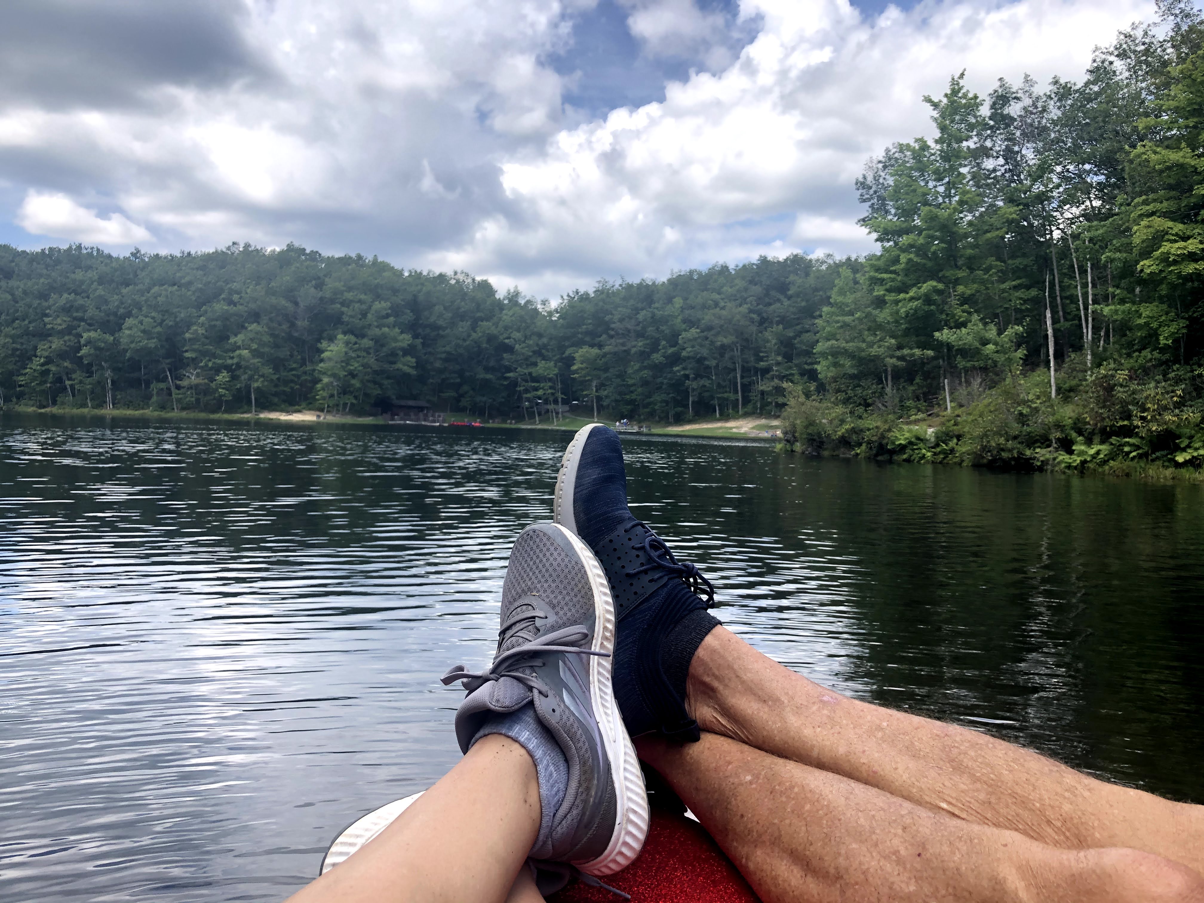
Ben and Allie enjoying some time sitting down along the river bank

Today marks the end of our first week in Kennerdell.  We arrived last Sunday at just about the exact time I'm writing this post, around 5:00 PM.  We chose this area for several reasons. First and foremost was the close proximity to Ben (around 30 minutes).  We also chose it because it looked so beautiful, peaceful, relaxing and an easy place to avoid crowds.  Absolutely nothing has disappointed us in the first seven days, even though the activity around here picks up significantly on the weekend.

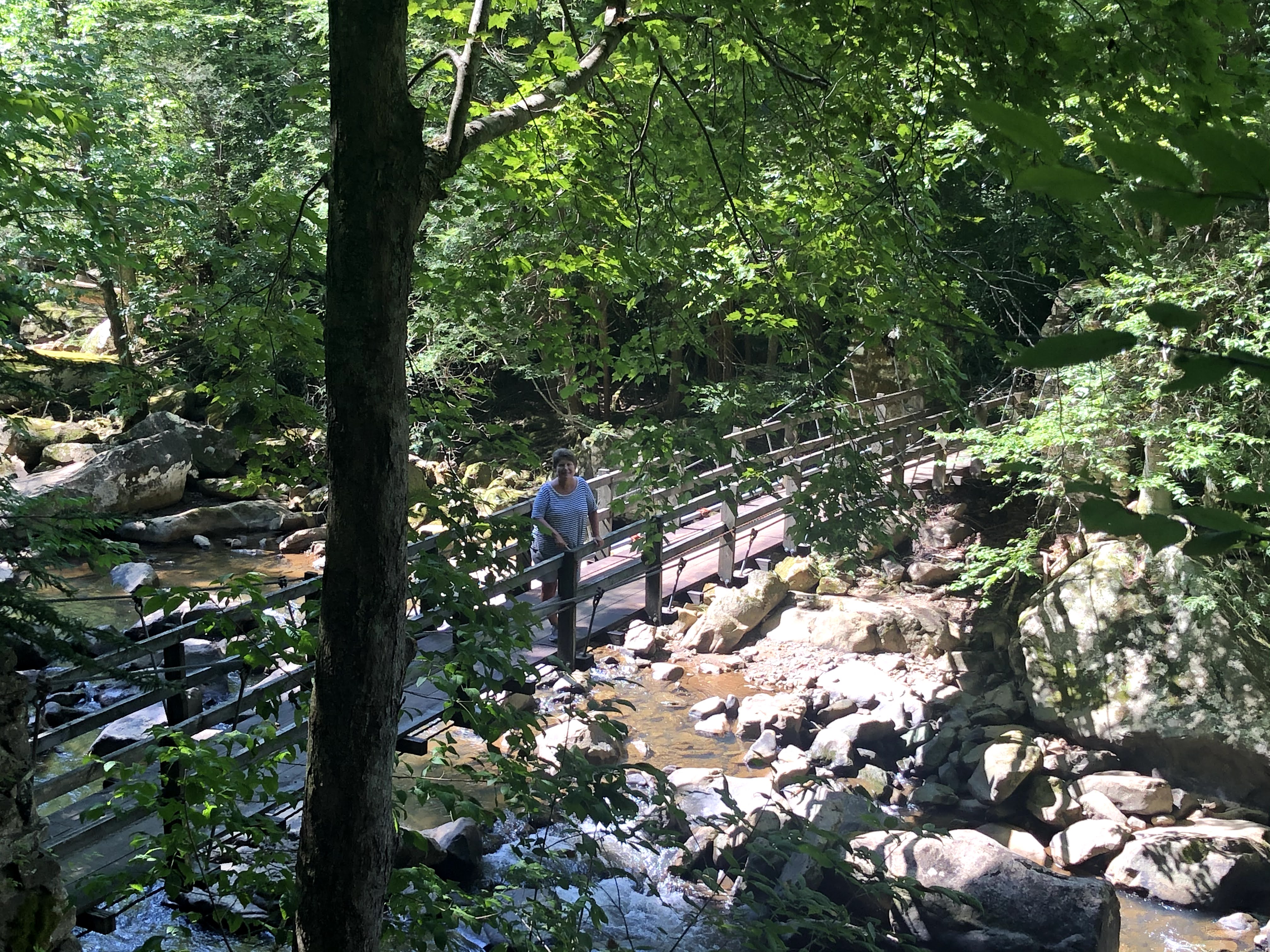
Allie taking Beth for a walk on the River Trail

Not wanting to be left out we picked up our pace over the weekend as well.   After spending some time at Ben's house on Saturday morning we came back and found ourselves in the middle of a three car traffic jam on the private gravel road that leads to our Airbnb.  Thanks to some skillful maneuvering by all three drivers we were all quickly on our way with simple waves and smiles instead of yelling, cursing and drawing weapons.  

The boat traffic on the river has also increased noticeably over the weekend.  During the week we'd typically get 1-2 boats pass by.  Today, the boat traffic has more than doubled.  I've counted five different boats zipping along the river!

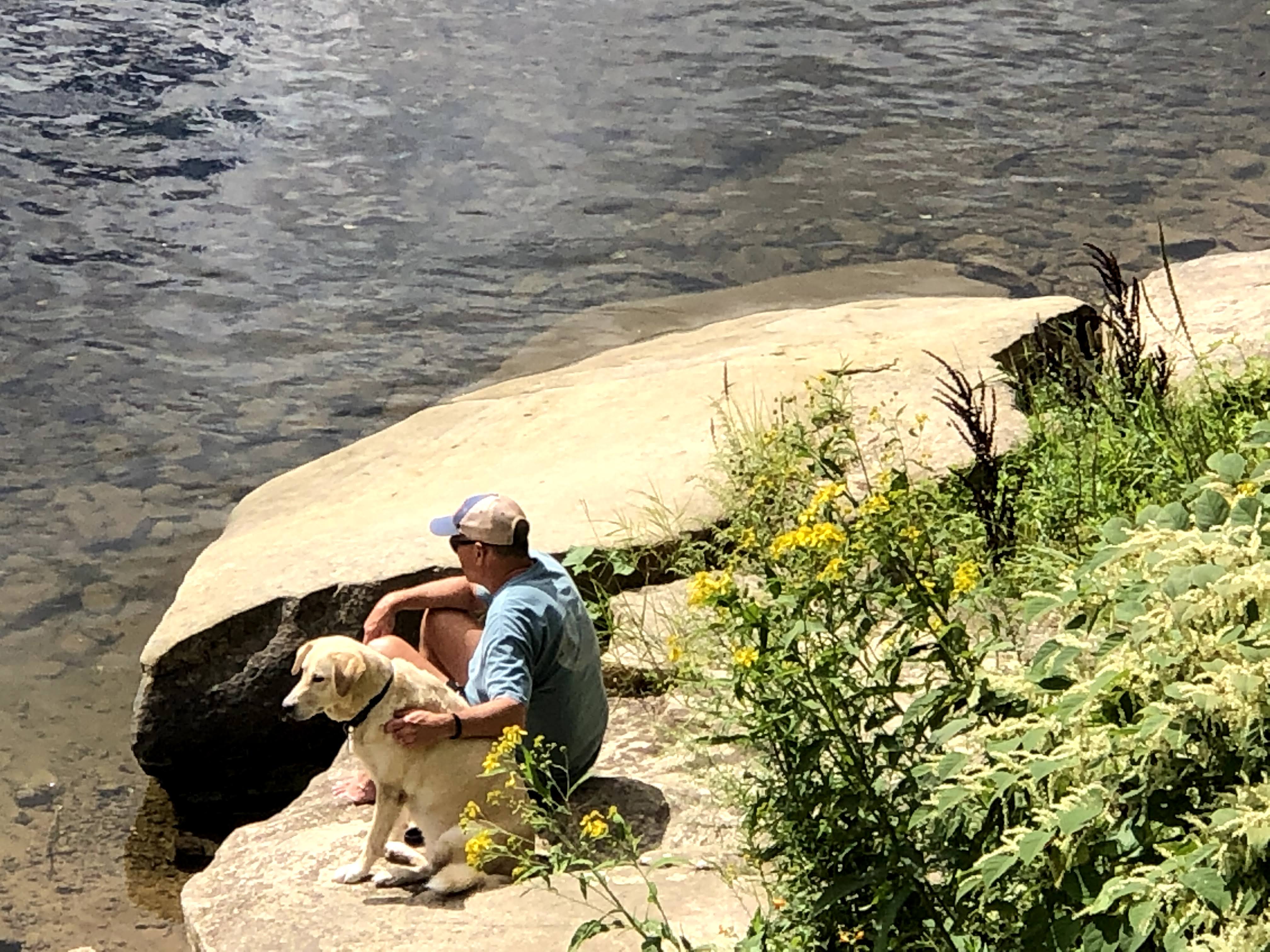
Allie was here all day and she could count the number of different boats on one paw!

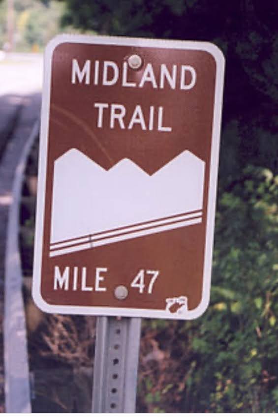
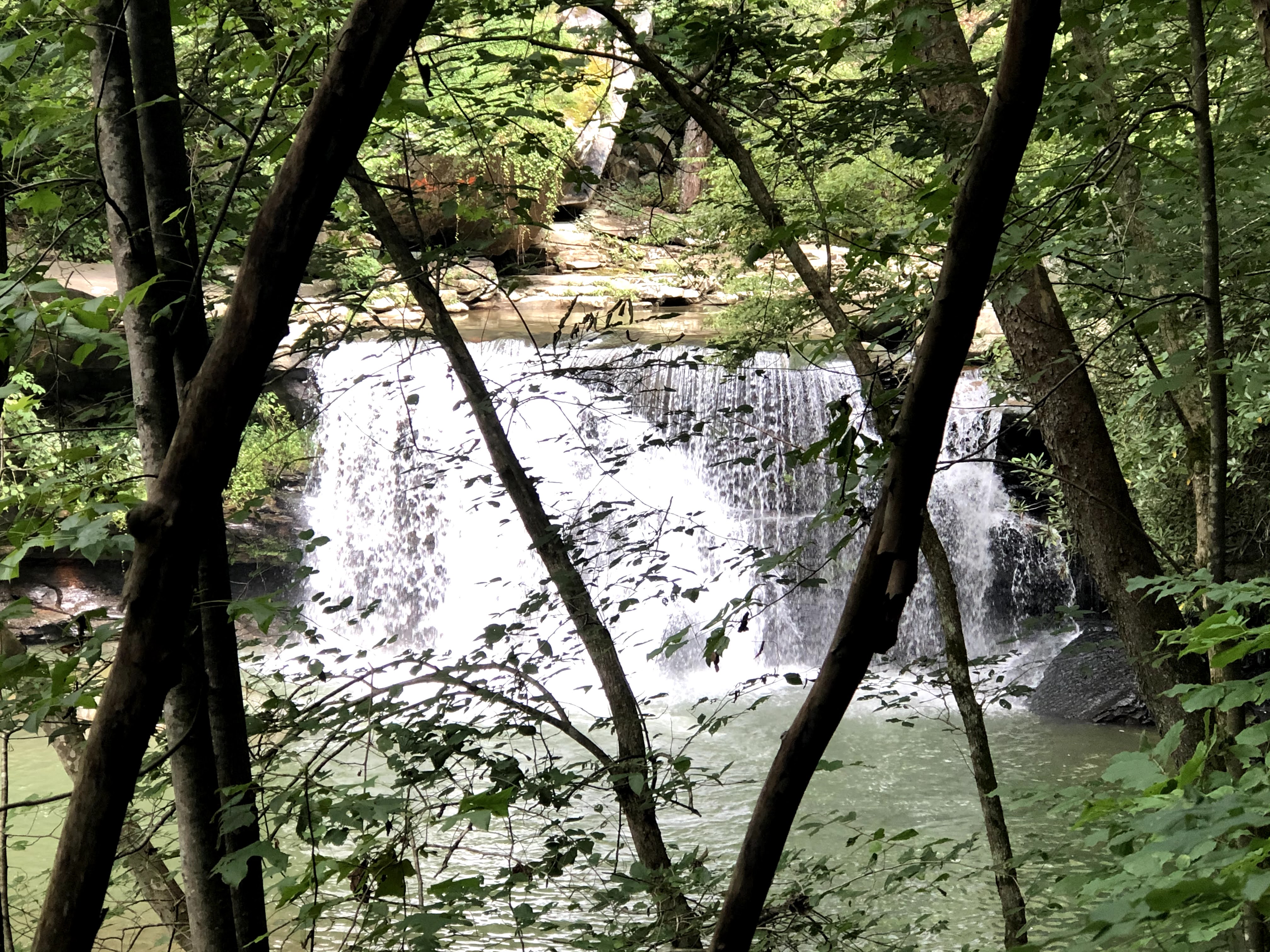
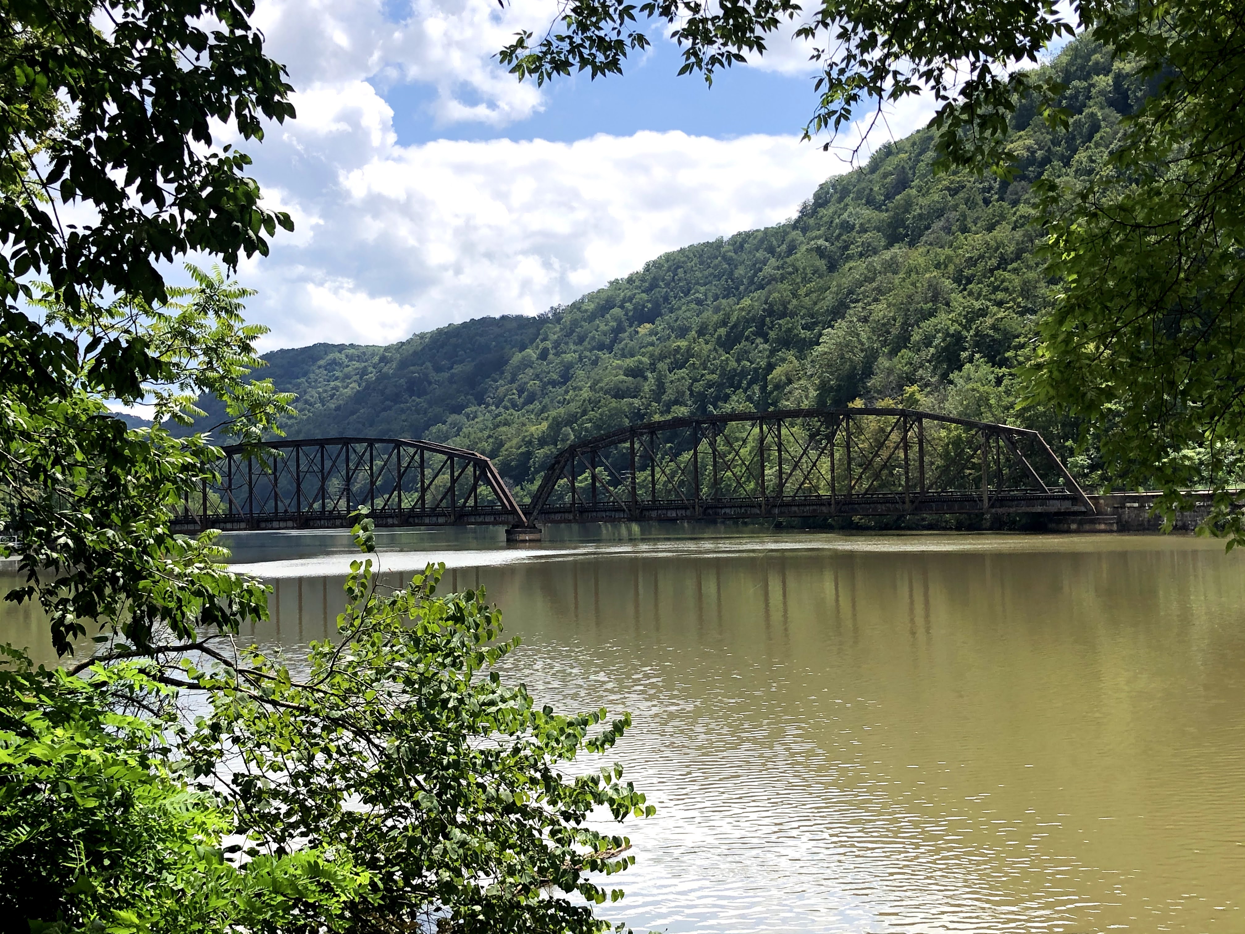
Late Saturday afternoon we ventured out to find and explore a portion of the Sandy Creek Trail.  This is a twelve mile paved multi-use trail that as the name implies, runs along Sandy Creek before it empties into the Allegheny River.  Like the Allegheny River Trail, which it intersects with, it too is a "rails to trails" conversion.  Sandy Creek is rather small and not always visible, but this does not diminish from the spectacular scenery along the tree lined trail.  From the trail head where we started (Rockland Road) we walked three miles to the 1,385 foot long Belmar Bridge that was built in 1907 with the financial backing of John D. Rockerfeller.  It was built with the intention of being part of a rail system between New York and Chicago.  However, according to what I read it mainly served as a bridge for the local coal industry.  The bridge is a really cool site to see, walk or peddle across while imagining back to the early part of the 1900's when the coal industry was booming in this area.  In addition to the Belmar Bridge we crossed five smaller bridges and passed through the 967 foot long Mays' Mill Tunnel.  Unlike the curved Kennerdell Tunnel, the Mays' Mill Tunnel is straight so there is light at both ends of the tunnel!  

The Belmar Bridge

Entrance to the Mays' Mill Tunnel.......if you look closely you can see light at the end of the tunnel

One of the five smaller bridges we crossed on the Sandy Creek Trail.

Sandy Creek from one of the bridges

Today has been a fun filled day of dog sitting.  We picked Allie up early this morning before Ben went to work and kept her until he got off and came to get her.  On the way back from his house this morning we passed a special treat along the road.  Although Lancaster County is considered "Amish Country" in Pennsylvania, we have discovered that there are quite a few Amish families in this area.  This morning on one of the small roads, within just a couple of minutes, we passed eight Amish families riding along happily in their horse drawn buggies on their way to worship.  As we passed by, there were smiles and friendly waves from both parents and children.  

We were up well before this picture was taken.  The night sky was amazing.

Ben and Allie took off about an hour ago.  The sun will be setting soon and we'll have survived the wild and wooly weekend in Kennerdell.  Thankful that we found this riverfront paradise in Northwest Pennsylvania!  

All the reasons we chose Kennerdell in one picture!


Thursday, August 27, 2020

The Kennerdell Tunnel............a once in a lifetime experience!

Entrance to the Kennerdell Tunnel

We've only been in Kennerdell for a few days, but we've quickly fallen in love with so much that it has to offer.  We love the outdoors and there's plenty of outdoor stuff here, and at this time of the year pleasant temperatures to enjoy doing it in.  I meant to bring a fishing rod, but in spite of my sister in law Debbie's reminders, I forgot to pack it.  We debated bringing bikes but decided against it since we're not sure of our next moves after Pennsylvania and Michigan.  If we run across a canoe/kayak rental nearby there is a good chance we'll do a little paddling on the Allegheny River.  We're just getting started!


It's early, but there is starting to be some evidence of the leaves changing color in some of the trees.


Foggy sunrises are a great way to start the day in Kennerdell.

What we did come armed with are two lawn chairs and a couple of pairs of shoes for hiking the numerous trails.  So far we're putting those items to good use.  The lawn chairs have been put to use for social distancing visits with Ben in his back yard, as well as for sitting in the shade watching the river flow by.

We've done a couple of hikes along the Allegheny River Trail.  This flat, well maintained, paved trail is a part of the nationwide "rails to trails" program.  The thirty two mile, hiking and biking trail runs from Franklin to Parker.  Additionally, it is part of the not yet completed Erie to Pittsburgh trail system.  When completed, the Erie to Pittsburgh Trail will be 270 miles in length. In the future we'll branch out to other trail heads and explore different sections.


Butterflies and wildflowers are plentiful along the trails.

Our house is on a privately maintained single lane road that is about two miles in length.  Along the road there are around twenty or so homes overlooking the river.  We've met a few of our "neighbor's" as we've walked the road and they have all been super friendly.   At the end of the road there is a small path that gives us access to the Allegheny River Trail.  Our access point is at the fifteen mile post, pretty close to the center of the trail.  Turning right onto the trail we walk towards Parker.  Turning left, we are heading towards Franklin.  There's an added attraction to turning left onto the trail, the Kennerdell Tunnel.

We had read about the Kennerdell Tunnel prior to our arrival and were excited to give it a try.  The tunnel was built in 1916 by the Pennsylvania Railroad.  Given it's central location, it's the centerpiece of the Allegheny River Trail.  At 3,300 feet in length it is the longest of the two tunnels on the trail (the Rockland Tunnel is 2,868 feet).   It is currently listed as the thirteenth longest pedestrian/bike tunnel in the world!

A unique and somewhat frightening feature of the Kennerdell Tunnel is that there is a curve near the middle.  This means that for a few minutes hikers and bikers are immersed in total darkness with no evidence of light in either direction.  Thankfully we had read about this portion of the trail and were armed with a small flashlight to keep us on the path.  

Heading into the tunnel


After about a minute of walking in complete darkness Beth assured me that one trip through the tunnel and back would be enough for her during this lifetime.  As for me, I'd doing it again but there's no way I'd do it by myself!  There's rumors that not only is it long and dark but that its also haunted! 


The exit is near........."Go To The Light"


Tuesday, August 25, 2020

Kennerdell, PA!


Early morning wildlife spotting from the deck of our home.  I've got the two essential tools in hand,  binoculars and coffee!

While searching Airbnb for a location close to Ben we spotted Kennerdell.  Kennerdell is a little off the beaten path.  Which given these crazy times is just the way we like it.  To get to this small, very serene, unincorporated riverfront village located in Venango County you'll probably need a GPS or a real good sense of direction.  If you do find it, you'll be really glad that you did.  It's definitely a slice of paradise along the Allegheny River.

A foggy sunrise on the Allegheny!

Geese coming in for a landing.  In addition to geese we've also spotted deer, a river otter, rabbits and numerous birds.

According to information I've read about the history of the area it was a trade stop along the Allegheny River prior to the War of 1812.  Barges loaded with wool, coal, timber as well as produce from local farms were shipped down the river to Fort Pitt (Pittsburgh).  In 1853 Richard Kennerdell purchased a wool mill located along one of the tributaries of the Allegheny.  By 1865 the area which would later become Kennerdell not only had a mill but also a blacksmith shop, sawmill, gristmill, church, school and general store.  The mill closed following Kennerdell's death in 1873, however he and his families legacy continues to live on today in this remote area of Western Pennsylvania.

The Kennerdell Overlook

For the next four weeks we'll be calling Kennerdell home.  We're staying at a place overlooking the clear, easy flowing water of the Allegheny as it makes it's 325 mile journey towards Pittsburgh.  There it will join the Monongahela River to form the Ohio River which flows into the Mississippi River and on to the Gulf of Mexico.  In this neck of the woods the river twists and turns along the route.  It's overall flow is in a Southwesterly direction, although in front of where we are staying the flow is northward.  

While here, there will be plenty of hiking on the extensive trail system, exploring the area, my daily whipping at Scrabble, frequent visits with Ben and plenty of sitting quietly and watching the river go by.   For some people, this laidback lifestyle would make their head explode.  For us, we've mastered the fine art of nothingness.  In Kennerdell we're looking forward to further perfecting this skill.

Yesterday we took a short drive over to Freedom Falls.  We expected to see this...........

..........instead we saw this.  Not much rain up here at this time of year!

Saturday, August 22, 2020

West Virginia wrap up........

Early morning fog over the New River (Hawks Nest State Park)

Yesterday we left West Virginia heading towards Northwest Pennsylvania where we will be spending the next four weeks.  We'll be staying at an Airbnb located directly on the Allegheny River in the small community of Kennerdell.  According to the 2010 census, Kennerdell's population was 247.  I'm not sure if it's gone up or down over the last 10 years, but social distancing won't be an issue!  Ben lives in Slippery Rock, which is about 30 minutes away.  We look forward to spending lots time with him and his incredibly loving dog Allie during our stay.  It'll be a blast!

Upon arrival in Slippery Rock we did some "social distancing" visiting with Ben in his back yard.

Allie was ignoring the CDC guidelines for social distancing!

At the risk of starting to sound like I'm blogging for the West Virginia Tourism Association or the state park system, West Virginia was awesome from beginning to end.  Our four hour drive from Hawks Nest State Park to Slippery Rock, PA yesterday was scenic the entire way, especially in West Virginia.  We traveled mainly on US 19 and I-77.  Typically interstate driving isn't the most scenic but Beth and I commented that the scenery on I-77 was every bit as nice as that along US 19, which is designated as a "scenic byway".

Summersville Lake has 2,700 acres of water surface and over sixty miles of shoreline.  It's formed by a dam on the Gauley River.  It's just a few miles off US 19.

Water flowing out of the Summersville Lake Dam.  Whitewater Rafting is popular further down the Gauley River.

The Gauley River

As we made our way closer to exiting West Virginia we fired up the same song that we played as we were leaving Anna Maria Island last Sunday morning.  That song?  Of course it was the John Denver classic.............Take Me Home, Country Roads!


Ben and Allie's home in Slippery Rock!


Thursday, August 20, 2020

Babcock State Park and the Midland Trail


The Glade Creek Gristmill

Just a short thirty minute drive from our lodge at Hawks Nest State park is another one of West Virginia's fantastic parks, Babcock State Park.  This 4,127 acre park has all the typical activities you would expect to find, such as camping and cottages,  miles of hiking and biking trails, picnic areas and a small lake.  One unique feature of the park, and it's most popular attraction is the Glade Creek Grist Mill.  This fully operational mill is actually a replica of another mill (Coopers Mill) that was located on the same site.  Although we didn't purchase any (mainly because we forgot to stop by on our way out), freshly ground corn meal can be purchased in the parks headquarters/camp store.

Swinging Bridge on Glade Creek

The grist mill again, this time as a "close up"......it's so scenic it's worth two pictures

The lake at Babcock State Park.  The trail that circles the lake is mostly flat and a little over a mile in length.

Paddle boats, canoes and row boats are available for rent.

We enjoyed visiting the mill and did a couple of relatively short hikes.  One of the hikes was on the Lake View Trail, which circled the lake.  Only one thing was missing along this relatively flat, well used trail and that was views of the lake!  Other than the first and last several hundred yards of the trail we only occasionally caught glimpses of the lake.  No complaints though, there were places to "sit and ponder" at a couple of places along the way.  After the hike we also enjoyed taking a paddle boat on the small lake.

One of the many species of mushrooms along the Lake View Trail

Sitting and pondering.....one of my specialties! 

Taking a few minutes break from the rigors of paddle boating!

The overlook from near the Manns Creek Picnic area

The drive to Babcock State Park was a treat in and of itself.  It was along a section of US Route 60 known as the Midland Trail.  This nationally designated scenic byway runs approximately 100 miles from Charleston to the unincorporated community known as Sam Black Church.  The trail was believed to have been originally cleared by buffalo and Native Americans.  In 1790 George Washington ordered the trail to be further cleared and improved.  It was used by both stage coaches and later by soldiers in the civil war.

The close proximity of several interstate highways has driven many small businesses away from the once thriving communities along the Midland Trail.  However, if you're looking for a beautiful drive along a well maintained and historic route,  the Midland Trail and a stop at Babcock State Park just may be right up your alley.  

Wednesday, August 19, 2020

West Virginia Extended.....Camp Creek State Park and Hawks Nest State Park

The view from our balcony at Pipestem State Park on our last morning.

We've put Pipestem Resort State Park in the rearview mirror.  It was a great introduction to the West Virginia State Park System.  There are 37 parks that make up the system.  We won't get but a small sampling on this adventure but we are going to get a few more than originally thought.  Our plans were to head on towards Pennsylvania after leaving Pipestem, but we've made a slight change, and are going to be spending a few extra days in West Virginia.

With school starting back, and summer travel winding down, we were fortunate to be able to book some time at another one of the beautiful state parks.  We are now at Hawks Nest State Park which is located in Ansted, just a few miles from the New River Gorge Bridge.  At 370 acres, Hawks Nest is much smaller than Pipestem (4,050 acres), but equally stunning in beauty.  The 31 room lodge sits on a ridge 750 feet above the banks of the New River.  The name "New River" is somewhat misleading since it is estimated to be approximately 65 million years old!     

Hawks Nest State Park

On our way to Hawks Nest we made a short detour off of I-77 to visit Camp Creek State Park and Forest.  This park is close to 6,000 acres in size with over 35 miles of trails for hiking, biking and horseback riding.  Additionally, for fisherman, there are over seven miles of trout streams that are stocked annually.  There were two small but very nicely shaded campgrounds.  One with water and electricity and another for tent campers.  Our visit was somewhat short but very enjoyable.  We did a little bit of a drive along the Turkey Loop Road to Campbell Waterfalls and a short hike to Mash Fork Waterfalls.  If we're back in the area, we'd look forward to exploring more of Camp Creek State Park.


Campbell Water Fall, Camp Creek

Marsh Fork Water Fall, Camp Creek


Camp Creek State Park

Our drive from Camp Creek to Hawks Nest also included driving across one of the most photographed sites in West Virginia, the New River Gorge Bridge.  This bridge is 3,030 feet in total length, with the main arch being 1,700 feet in length.  It stands 876 feet tall, meaning the Washington Monument and Two Statues of Liberty could pass underneath with 20 feet to spare.  The visitors center is currently closed due to Covid-19 but the observation platforms are open.  The view from the lower platform was well worth the energy expenditure required to go down and then back up the close to 200 steps.

The New River Gorge Bridge from the visitors center

I was serious about getting a good selfie at the New River Gorge Bridge

We arrived at Hawks Nest around 2:00 PM and were pleased to find out that our room was ready.  After a few minutes of rest and relaxation we were off to explore the park.  Like Pipestem State Park, Hawks Nest has a tram that runs from the rim down to the canyon floor along the New River.  The current cost for the tram is $7 round trip, unless you're old like me, then you get a one dollar discount.  These one dollar savings are adding up.

We hiked about half of the 1.9 mile Hawks Nest Rail Trail, which had a trail head near the lower tram station.  As the name implies, this trail is along a rail bed that is no longer in service.  In this case, the trains that ran here serviced the numerous coal mines that used to operate in the area.  The well shaded trail runs beside Mill Creek making the views of the meandering creek and occasional waterfalls spectacular.  We didn't turn around near the halfway point because of fatigue or boredom.........we turned around because we didn't want to miss the last tram of the day (currently 4:45).  It was a fun day and we knew we'd be back for more after a good nights sleep.

One of the many small waterfalls feeding into Mill Creek 

This entrance to an old coal mine (now sealed) was just off the Hawks Nest Rail Trail 
This railroad trestle across the New River is still in use.  
The tram on it's way to pick us up.

Sure enough, soon after a nice breakfast this morning we were heading back to the Hawks Nest Rail Trail.  This time instead of taking the tram down (it's currently closed on Wednesday's) we parked at the upper trail head in Ansted and hiked down the trail to the canyon floor.  Although the trail is an "out and back" trail, the views look quite different depending on if you are going down the gradual slope or hiking back up.  We've done a lot of hiking on a lot of magnificent trails, this was one of the best. 


Hawks Nest Overlook

Close up from the Hawks Nest Overlook.  The small building on the left side is the lower tram station

Hawks Nest Rail Trail

The largest waterfall on the trail.  It's at just about the mid point.

The most difficult part of the hike was deciding when to stop and take a picture.  It would have been easy to take a picture every step of the way.


Have stick, will travel.  Near the Ansted Trailhead.  

Ansted Trailhead

 Once we completed the hike, we took the car down the road on the opposite bank of Mill Creek.  This led us back to the lower trail head area.   We brought a couple of lawn chairs with us and we were soon relaxing in a shady spot along the edge of the New River enjoying the cool breeze and pondering why it took us so long to get to West Virginia. 

The view from our pondering spot!