Point Pinos Lighthouse has been guiding ships since February 1, 1855. It is the oldest continuously operating lighthouse on the west coast. It's just a short walk from our Airbnb.
The Pacific Grove/Monterey area is a paradise for exploring on foot. The daytime temperatures are pleasantly cool (high's have been around 60 degrees), the California sunshine is abundant, and the scenery along the Pacific coast is amazing. While enjoying time exploring the coastal trails, we are constantly spotting seals, sea lions, and sea otters. Additionally, there are several species of whales that reside or pass by Monterey Bay throughout the year. Right now, the most common ones are the Humpback Whales. We've enjoyed spotting their spouts of water vapor as they come to the surface for air. Making the coastal trails even better is the fact that there are plenty of benches along the way. These trails were designed to be savored. So instead of making any attempt at land speed records, we're certainly doing a lot of savoring.

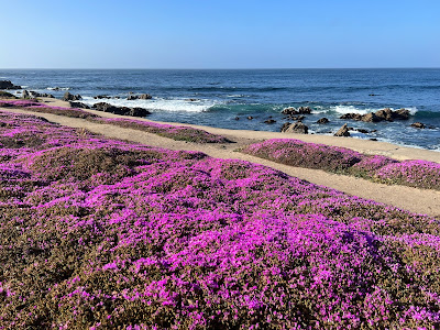
The Magic Carpet of Pacific Grove. In 1943 a local resident and gardener named Hayes Perkins began to clear poison oak that was spreading along the shoreline. He replaced it with groundcover that he had brought back from a trip to South Africa. He hand watered and nurtured the plants for years. His care resulted in what has become close to a mile long "magic carpet" that blooms in April and lasts through May/early June.
Another view of the Magic Carpet along the Monterey Bay Trail.
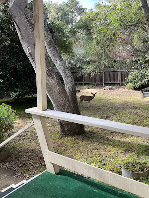
Sometimes the wildlife comes to us. This little guy is peaking through our living room window.
Mom in the backyard. The baby is behind the tree,
From our Airbnb we've enjoyed heading off in different directions. As I mentioned in a previous blog, going three different directions (north. west or south) we'll be along the shoreline in about fifteen minutes. Going eastward isn't bad either. Following the pedestrian friendly, Lighthouse Avenue and Pine Avenue leads us into downtown Pacific Grove which is filled with numerous shops, restaurants and a Monday afternoon Farmers Market.
Pacific Thai Cuisine (nice lunch spot)
Pacific Grove Farmers Market
The coastal trails are the Monterey Bay Recreational Trail and the Asilomar Trail. Both trails are flat, are accessible to the other, have plenty of parking along the way and are equally spectacular. The Monterey Bay Recreational Trail connects Pacific Grove to Monterey, making accessing the Monterey Aquarium and Cannery Row by foot easy and fun. A little further down is the Old Fisherman's Wharf, which is a smaller version of San Francisco's Pier 39.
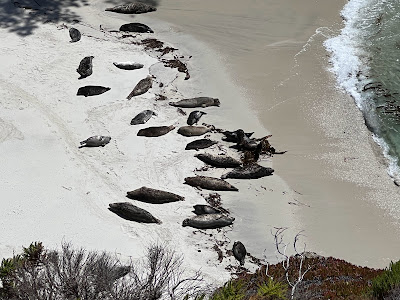
Mom and baby harbor seals relaxing along a protected section of the beach.
Berwick Park. This wood carving is from a tree trunk(s).
Our Airbnb host told us about the Coast Guard Pier earlier this week. It's a little hidden from view between Cannery Row and the Old Fisherman's Wharf. There were only a few other people on the 1,000 foot long walk way when we visited. As recommended, we planned our visit at low tide and enjoyed standing just a few feet above several sea lions that were taking a break from the water to catch a little afternoon sun. Thanks Dick, we appreciated this and all of your recommendations!
The Coast Guard Pier can easily be missed, but it's a great place to walk, especially at low tide. You never know who you might find basking on the rocks..........
............like this very relaxed sea lion!
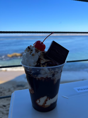
All this walking calls for a little occasional indulgence! There's a Ghirardelli's on Cannery Row.
The Asilomar Trail is a 3.6 mile out and back trail that passes sandy beaches interspersed with rock formations that are constantly being pounded by the crashing waves of the Pacific. From the south end of the trail, it's easy to continue along, passing Spanish Bay Beach, Point Joe, China Rock, Bird Rock, Seal Rock and much more of the Pebble Beach community.
This memorial to John Denver is located along the shoreline between the Monterey Bay and Asilomar Trails. He died when the plane he was piloting crashed about 150 yards offshore on October 12, 1997.
While we enjoy leaving the car parked as much as possible, the 17-mile drive is also a highlight of the Monterey Peninsula. This drive is along the main road through the gated community of Pebble Beach. For non-residents there is a toll of $11.25 to make the drive, which follows the coastline and passes by both the golf courses and various other points of interest. It's well worth the price of admission and is reimbursed if you spend $35 or more at a Pebble Beach Resort restaurant. We enjoyed a nice outdoor lunch at the Gallery Cafe which overlooks the first tee of Pebble Beach Golf Club.
This lone cypress tree has withstood the elements for over 250 years. It is the logo for the Pebble Beach Golf Links and the Pebble Beach Company.
The Gallery Cafe is open to the public and overlooks the first tee of Pebble Beach. The Wall of Champions honors not only the winner of the annual tournament but also those who have won major championships here.
This young buck is guarding the 14th green at the Monterey Peninsula Country Club.
The appropriately named "Bird Rock". It's covered with pelicans, sea gulls and cormorants......and whitewashed with ..................
Pebble Beach Golf Links
My brother encouraged me to rent a set of clubs and tee it up at Pebble Beach. It sounded like a great idea but that's a big price to pay (greens fees are currently $595) for drowning a few golf balls in the Pacific Ocean!
Yesterday we did a second, but shorter, drive southward down Highway 1. Our turnaround point was at McWay Falls in Julia Pieffer Burns State Park. There were a few stops along the way including the Garrapata State Park, Bixby Bridge, Big Sur River Inn and lunch with a view at Cafe Kevah before finishing the day with a beach walk at Carmel by the Sea. In 1986 Clint Eastwood was elected mayor of this small beachside community, beating the incumbent in a landslide (2,166-799). He served as mayor for two terms and is credited with leading numerous initiatives that brought the city back from near bankruptcy. I guess you could say he made their day!
Along the Garrapata State Park Bluff Trail.
The views along the Big Sur section of Highway 1 are spectacular.
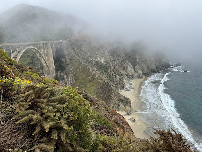
June is typically the foggiest month. We have had very little fog until yesterday, which happened to be June 1. The fog made for a nice picture of the Bixby Bridge and it lifted shortly thereafter.
Much of California has had several years of drought conditions but the water is still flowing from McWay Falls. At high tide the water falls directly into the ocean.
The chairs in the river behind the Big Sur River Inn were calling..........
........so of course we answered the call!
Our final stop of the day......... Carmel by the sea.


