Friday, October 23, 2020

The not quite direct route back to Florida...........

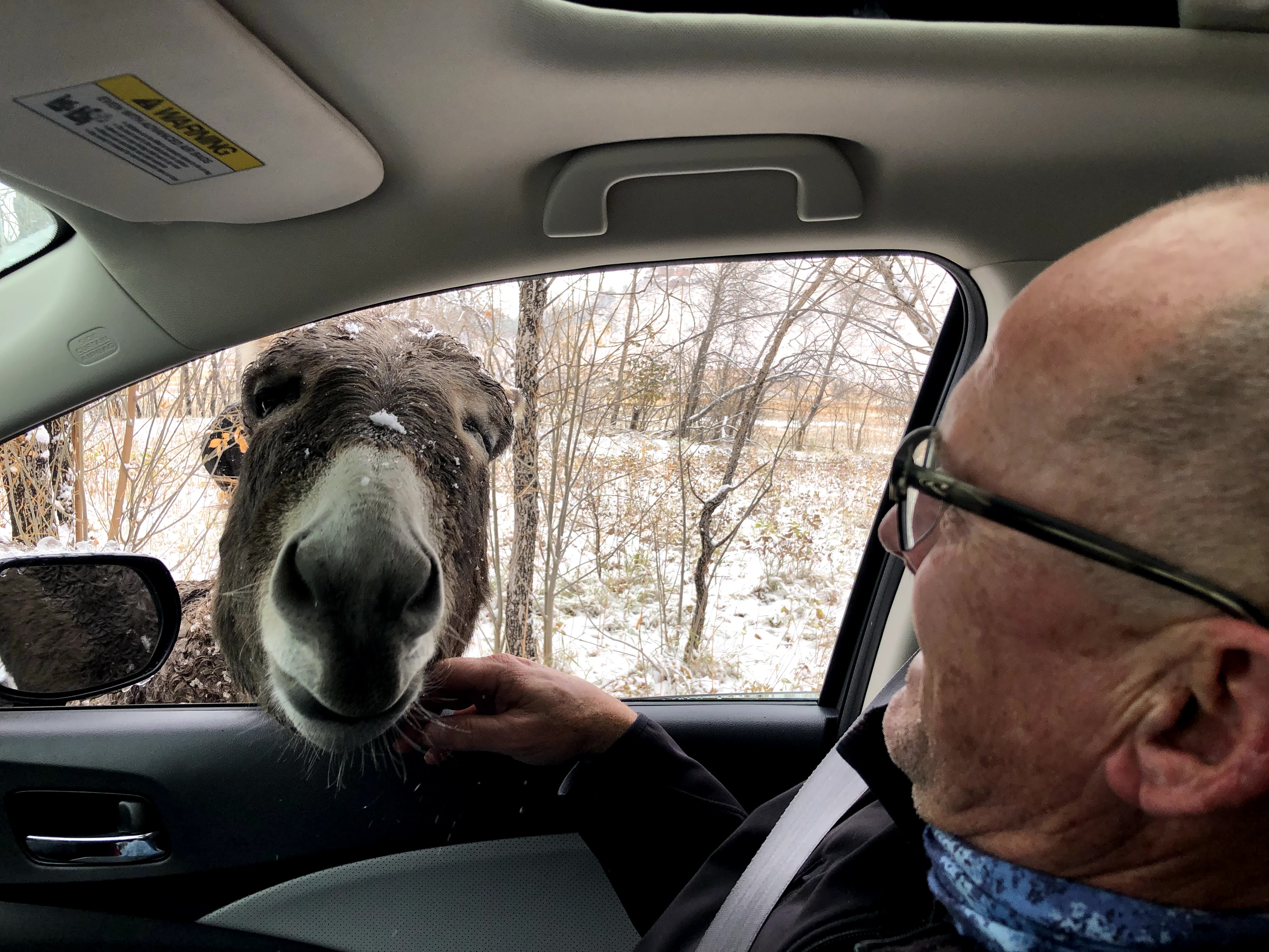
Me and my new best friend from Custer State Park!

Technically we're on our way back to Florida.  We left the Upper Peninsula of Michigan very early Wednesday morning.  The most direct driving route would have been simply to make our way to I-75 and point the Silver Bullet south.  In a couple of days we'd be back in the sunshine state.  Even though Florida is our current "home base", the journey isn't ending.  After some time in Florida we'll be making our way towards California for the Thanksgiving and Christmas holidays.

So we're on our way back to Florida by way of Sioux Falls and Hill City, South Dakota and Denver.  So far our journey back to the sunshine state has been quite snowy.  About an hour out of Munising the evidence of a fresh snowfall began to show on the ground and trees.  It continued as we made our way south towards Green Bay (it's rare one gets to drive south to Green Bay) and then across Wisconsin.  The accumulation seemed heaviest in Minnesota, especially near St. Paul.  I learned later that St. Paul had actually had around 6 inches of snow earlier.  As we made our way into South Dakota there was less snow and even a little bit of sunshine.  We reached Sioux Falls, our destination for the night, around 4:00 PM.  It had been a long travel day but we wanted to check out Falls Park in the downtown area.  


A couple of images from out the window as we drove through Wisconsin's dairy land.


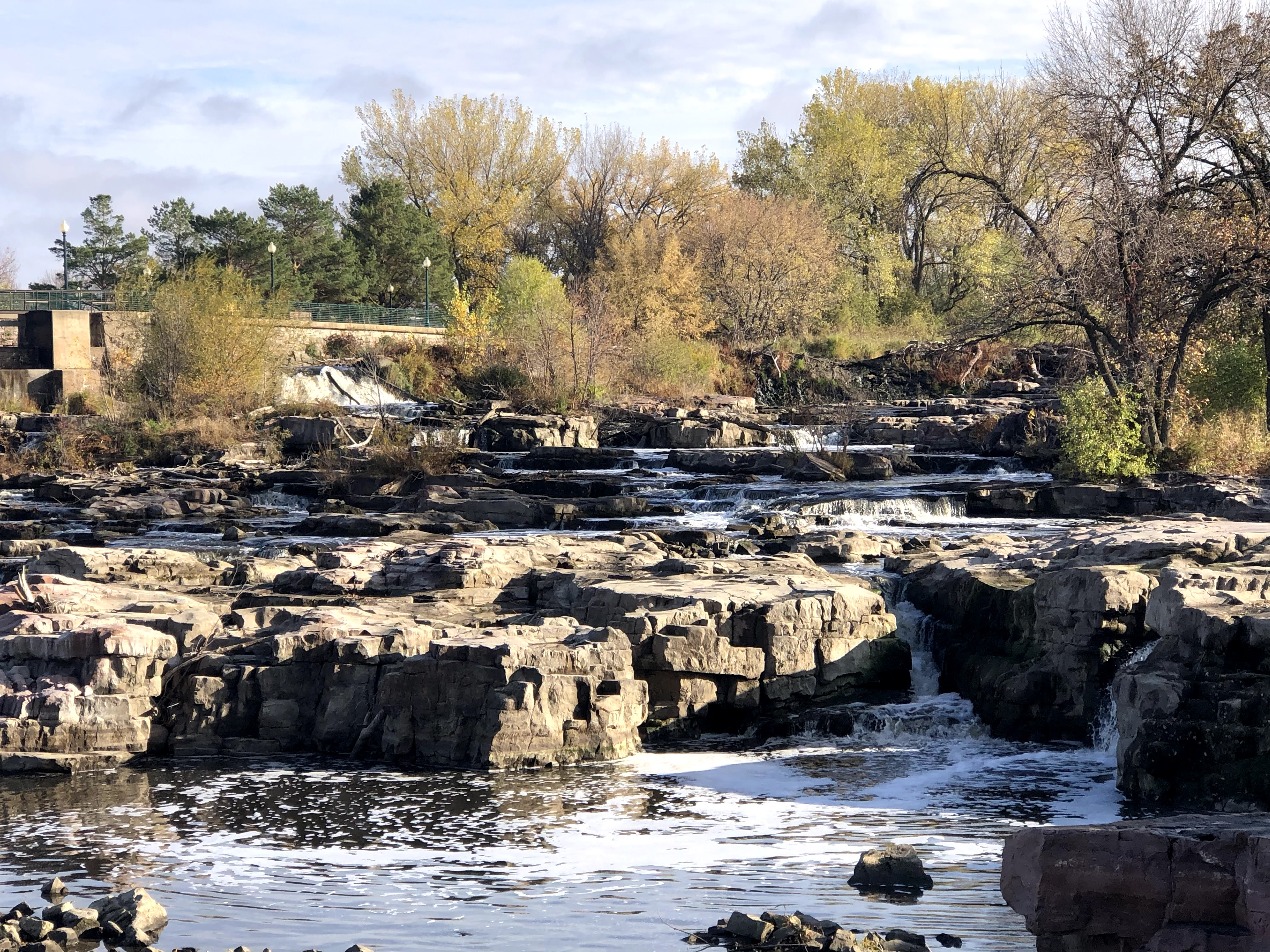
Falls Park is a 120 acre public park through which the Big Sioux River flows.  As the river runs through the park the water cascades down numerous waterfalls of various sizes that have been carved in the natural rock.  There are a number of trails and observation decks, each providing different views as the close to 7,500 gallons per second make their way downstream.  Even though the sun was occasionally peaking out, it was quite chilly so we didn't stay too long.  We were impressed with what we saw of both Falls Park and the city of Sioux Falls.


Falls Park near the downtown area of Sioux Falls.........


it may have looked sunny but it was around 30 degrees with a little bit of wind.......


the park is described as "a thousand waterfalls in one".........


the description seems accurate!


Remnants of the Queen Bee Flour Mill along the Big Sioux River in Falls Park.  When operational it was the largest flour mill in the area.

The Arc of Dreams Sculpture over the Big Sioux River in downtown.  The gap in the sculpture represents the leap of faith required to turn dreams into reality.

Day One of our drive towards Denver we enjoyed seeing the snow on the ground.  Driving from Sioux Falls to Hill City we were a part of the action.  It snowed pretty much the entire day, although thankfully not enough to impact the drive or the activities we had planned along the way.

Hill City is a very small town located in the Black Hills of South Dakota.  It's about 30 miles southwest of Rapid City and centrally located to a number of amazing places to visit in this area.  Nearby is Mount Rushmore, Custer State Park, Crazy Horse Memorial and much more.  We had visited this area previously and stayed in Rapid City.  We found it to be an interesting city that we'd like to visit again, but that will have to be somewhere down the line.

We had an ambitious "things to do" list for the day.  Thanks to an early start we were able to get all three in and make it to the hotel before sunset.  First up was Badlands National Park which is conveniently located just a few miles off I-90 between Sioux Falls and Rapid City.  Badlands is nearly a quarter million acres in size and is known for it's unique geological features that were a few million years in the making.  The National Park Service describes it as "the land of stone and light".  For our visit it could have been described as "the land of stone, not much light and a lot of snow".  The snow enhanced the large buttes and valleys that have been carved by wind and water erosion and a whole lot of time.  The heavy snow had closed the Badlands Loop Road at one of the higher passes so we had to exit the park through the entrance we had used (Northeast Entrance).  No problem, the scenery was spectacular both directions.


If you're my age you probably remember the cartoon character "Badlands Meanie"....this isn't him


We ran across this big horn sheep less than 5 minutes in the park.


A kind heart in the heart of the Badlands!


A Badlands Selfie!

We made a quick stop at the Wall Drug Store in the town of Wall because that's what all travelers through the area do.  The drug store is actually a collection of stores and restaurants under one roof.  Yes, the drug store that started it all back in 1931 is still open.  It's quirky and fun to spend a little time at Wall Drugs.  You won't be alone, it attracts over two million visitors per year!


The World Famous Wall Drugs!

Fudge is medicinal, isn't it?

From Wall it was on to Custer State Park.  The park was named after Lt. George Armstrong Custer who was famously killed in the battle of Little Big Horn (which is actually in Montana).  The Civilian Conservation Corps built miles of roads through the park in the 1930's.  It now has several lodges, campgrounds, lakes, hiking trails and more.  It is also known for it's abundant wildlife including a herd of over 1,500 buffalo that roam freely in the park.  The Wildlife Loop Drive through the park was amazing even though the buffalo had decided to freely roam away from the drive while we were there.  We did get up close and personal with the "begging burros", enjoyed watching a coyote try, with no luck, to catch a prairie dog not paying attention, numerous deer and turkey.  As much as the wildlife was a treat, just the drive itself was enjoyable as it passed through both prairie land and snow covered pines.


Guess where?


The begging burros of Custer State Park!


The ass end of a jackass!


Turkeys on the move........Thanksgiving is soon!


The prairie dogs were way too smart and communicate with each other too well for this coyote!


On the lookout for coyotes!

Custer State Park

We finished our day at Mount Rushmore.  Thankfully the "cancel culture" hasn't taken this spectacular monument honoring Presidents Washington, Jefferson, Lincoln and Roosevelt down.  The sculpture which was designed by Gutzon Borglum took over fourteen years to build.  The 60 foot faces of these four early leaders are inspirational to see as they look out over the Black Hills, although I did detect a little sense of bewilderment on their faces as if they were wondering "what the heck is going on these days".


Next up we will be driving to Denver.  We'll be leaving the Silver Bullet at an airport hotel and flying back to Florida for the next few weeks.  I'm sure she'll enjoy the rest before heading on westward.    


The Silver Bullet looks like it could use a break!


Monday, October 19, 2020

Lake Superior...........a well named lake!


Lake Superior from the top of Sugarloaf Mountain in Marquette.

In our travels we've now seen all five of the great lakes.  Before visiting the Upper Peninsula we had spent time along the shores of  Lakes Ontario, Erie and Michigan.  We caught a glimpse of Lake Huron as we crossed the Mackinac Bridge on our way to the Upper Peninsula. Not intentionally but we saved the biggest and arguably the best for last.  It's hard to believe our time here in Munising is rapidly coming to an end.  Sadly, in a few more days we won't have Munising Bay/Lake Superior to enjoy out our back door.  

We've loved the sunrises, marveled at the changing leaves, been refreshed by the cooler temperatures, and absolutely amazed at how quickly the weather can change, change again, change again and again, all within a few minutes time. At night we stared up at what seemed to be thousands of stars on dark, clear nights.  The Upper Peninsula is everything we had heard it was and so much more.  We're already looking forward to coming back in the fall next year and we haven't even left. 

A sunrise sampler from our back yard.

I've mentioned Lake Superior in most blogs but I've also been learning more about it during our stay so I could do a blog just on this massive body of water. It's certainly worth it!

The Native American Ojibwe referred to the lake as "gitchi-gami", meaning "great sea".  You may have heard it referred to by this name in Henry Wadsworth Longfellow's poem The Song of Hiawatha or in Gordon Lightfoot's song The Wreck of the Edmond Fitzgerald.  I wasn't familiar with the poem, but I was familiar with the song that was released in 1976 about the shipwreck that occurred the previous year.  The song has been playing on a continuous loop in my head for much of our stay!

A few of the many lighthouses on Lake Superior........most are no longer active.


French explorers who visited the region in the 17th century referred to it as "le lac superieur" (Lake Superior).  At the time of their "discovery" they didn't name it Lake Superior because of it's size or depth.  They named it Lake Superior because the area they explored was above Lake Huron.  

At 31,700 square miles, Lake Superior is the largest freshwater lake in the world.  It's approximately 350 miles long and 160 miles wide.  If Lake Superior was a state it would be roughly the same size as the state of South Carolina.  There are over 1,700 square miles of shoreline, meaning that if you drove non-stop around the perimeter of the lake at 60 mph, it would take almost 29 hours to complete the trip. On your loop around the lake you'd pass through parts of Minnesota, Wisconsin, Michigan and Ontario, Canada.  

As impressive as it's size, it's depth is equally impressive. It's average depth is is 483 feet and at it's deepest point it's 1,333 feet deep.  The lake contains over 10% of all the freshwater on earth.  There's enough water in Lake Superior to cover all of North and South America with one foot of water.  

It's big and deep, and as you would expect, the water is cold.  The high surface temperature in the summer only gets to around 55.  During the winter the majority of the lake is covered by ice.  Occasionally the entire lake freezes over.  The last time this happened was in 2014.

There are around 300 tributaries feeding water into the lake which then drains into Lake Huron by way of the St. Mary's River.  While there is no tide activity on Lake Superior, there can be significant wave action on the lake.  On several stormy days we've seen waves that looked in the 6-8 foot range, impressive but no where near the 28.8 foot wave recorded in 2017 near Marquette.

Tributaries include waterfalls, rivers and streams of all sizes.....


As I had mentioned previously, the weather in this area can change rapidly and very dramatically.  This makes Lake Superior a very dangerous lake.  More than 350 shipwrecks have been recorded on the lake, none more famous than the SS Edmund Fitzgerald which sank along with it's entire 29 person crew on November 10, 1975.   

Beautiful, huge, cold, mysterious, deep, dangerous and so much more.  It's safe to say there's plenty to see and do on the legendary big lake they call gitchi-gami!

Wednesday, October 14, 2020

Pete's Lake Recreation Area and Seney National Wildlife Refuge


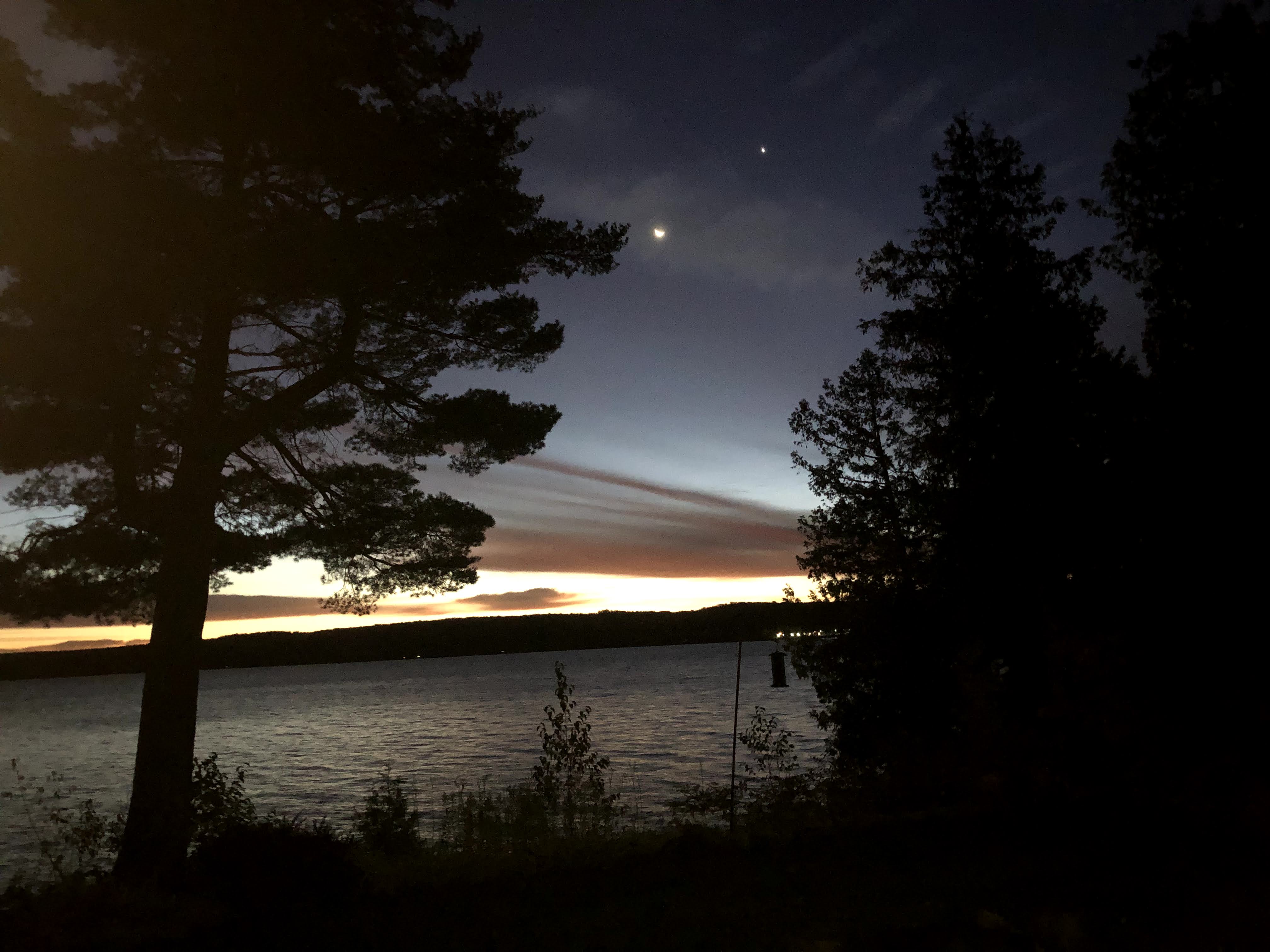
The Moon and Venus at sunrise over Lake Superior (Munising Bay) this morning.

The Hiawatha National Forest is close to 900,000 acres in size and has the distinction of touching the shoreline of three of the five great lakes (Superior, Michigan and Huron). As we drove through it on Saturday we knew we'd be going back to spend more time and do a little more exploring. Obviously, there is plenty to see and do in a forest that size.  One of the places we stopped for a few minutes was at Moccasin Lake.  We noticed there was a trail nearby called Bruno's Run that looked interesting and we decided that would be our destination.

Hiawatha National Forest

Sunday afternoon we drove back to Moccasin Lake by way of a brief stop at Wagner Falls, a very nice waterfall just outside Munising.  Although it had been less than 24 hours and the leaves were still quite colorful it was obvious that they were now changing rapidly.  In places many of the bright red, yellow and orange leaves were turning to brown, although we would occasionally hit patches that were at their peak color.


Wagner Falls

Wagner Falls

We did a little hiking on the Bruno's Run trail but found that it was a little too muddy to enjoy.  Not to be deterred, we drove around the area a little and discovered Pete's Lake Recreation Area.  We were able to park in an area near the boat ramp and enjoyed a nice long walk along the paved (no mud) roads near the lake.  Occasionally there would be a passing car or bike but we could count both cars and bikes on one hand as we enjoyed our time among the tall trees and colorful leaves.


The Silver Bullet at Pete's Lake.


We barely scratched the surface of Hiawatha National Forest but Pete's Lake Recreation Area was a nice place to visit.

Monday was a kind of "stay around the house day".  This was partly due to the weather and partly because we are enjoying where we are staying so much.  We had a fire in the outdoor fire pit and I did a little fishing along the shore.  I'm still getting shutout by the fish in Lake Superior, although that hasn't made the fishing any less enjoyable.  


It's a big lake.......no fish has disrupted my fishing yet by swimming into the hook.  This picture was taken shortly after we arrived.  Now my fishing is done in long pants and a jacket.

Yesterday morning we hopped in the silver bullet and made the short (40 minute) drive to the Seney National Wildlife Refuge.  The 95,000 acre refuge, which is managed by the US Fish and Wildlife Services, was established in 1935.  Prior to the establishment of the refuge the area was described as "barren and burned out"  Now it is a habitat and breeding ground for migratory birds as well as numerous other species of wildlife including moose, deer, beaver and porcupines.  As a result of it being near the end of the season (it closes Oct. 20) and the pandemic, the visitors center and some areas of the refuge were closed.  We knew this before heading that direction.  We were still encouraged by the nice things we had heard about the trail and seven mile marshland drive that were still open.  We certainly weren't disappointed.

Seney National Wildlife Refuge

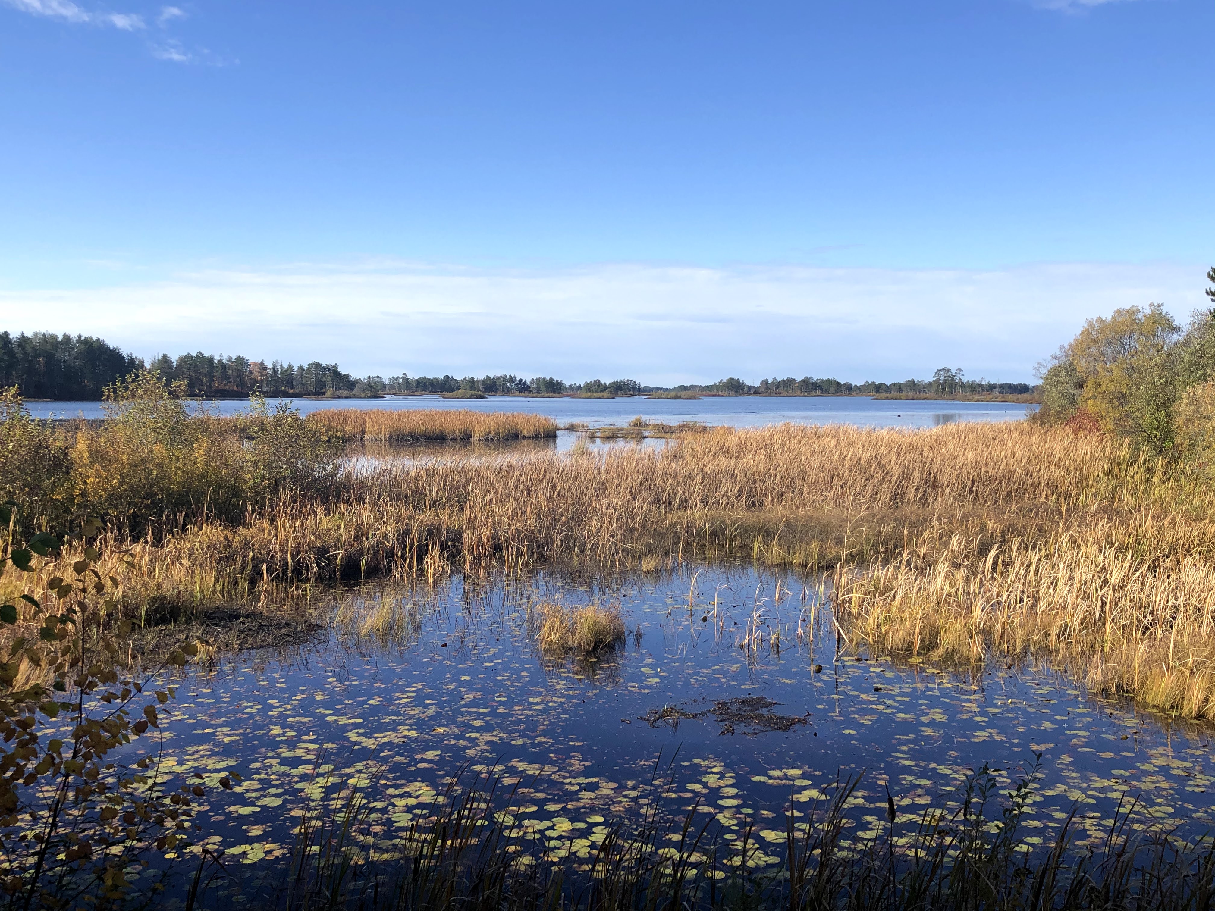
The trail was a 1.5 mile pine tree lined loop trail around several ponds.  Although many of the migratory birds have already packed their sunscreen and headed south for the winter there were still plenty of birds including quite a few pairs of Trumpeter Swans.  These birds have a wingspan of close to eight feet, making them the largest species of waterfowl in the world.  They were not only putting on a show with their takeoffs and landings but also feeding on bottom with their butts pointing skyward.


Trumpeter Swans taking off.


The birds and natural decay of this tree trunk have turned it into a nice looking coat rack.


A couple of scenes from the trail...........


The Marshland Drive was a longer version of the hiking trail.  It's a one direction, seven mile loop drive.  There are numerous places to pull out along the drive as well as three observation platforms for stopping and soaking in the surroundings.  Although we were hoping to see a few more animals, specifically moose, beaver and porcupine we loved our time and highly recommend that if you're in this area that you take some time to explore the peaceful, but very different, Pete's Lake Recreation Area and Seney National Wildlife Refuge.     


We thought these places along the Marshland Drive were perfect places for moose, beaver and porcupines to hang out........I guess they thought otherwise!


Sunday, October 11, 2020

Kitch-iti-kipi, Fayette and more color!


Kevin, Stuart and Bob enjoying a nice fall morning in the Upper Peninsula!

Sadly in these days of social distancing and wearing masks it's a little more difficult to visit with others while traveling.  Through the years many of the places we've visited and things we've seen have been from recommendations we've gotten from people we met along the way.  Hopefully, we've been able to share with them some ideas that they have enjoyed along their journey also.

Kitch-iti-kipi had been somewhat on our radar screen but not a high priority.  Fayette was not a place that we had even heard of a few days ago.  Thankfully we visited for a few minutes with a couple at an incredible overlook just a mile or so from where we are staying.  When Beth mentioned Kitch-iti-kipi they recommended it and suggested Fayette as well.  We did a little research and saw that those two destinations are somewhat close to each other and that it would make for a nice daytrip.  Our plans for Saturday were set!


As I had mentioned in a previous blog, there are so many scenic overlooks and parks in the Upper Peninsula.  This one is about a mile from where we are staying.  It's where we got the recommendations for Kitch-iti-kipi and Fayette.

Kitch-iti-kipi, as it was referred to by the Native American Ojibwe tribe, means "big cold spring", and that's exactly what it is.  With a flow of over 10,000 gallons a minute it is actually Michigan's largest natural freshwater spring and at a temperature of 45 degrees the water is plenty cold.  It's accurately named and an enjoyable place to spend a little time.


The Big, Cold Spring!

Kitch-iti-kipi is located in the Palms Book State Park close to the town of Manistique.  It was about an hour drive for us to reach the park.  There was a visitors center/concession area that was closed for the season.  The park was still doing a somewhat brisk business even on a chilly, breezy fall morning.  We  asked the employee at the entry gate what else there was to do in the park other than visiting the springs.  He thoughtfully and honestly answered "not much".  Not only was the springs accurately named, but the gate attendant was accurate in his answer.  

Palms Book State Park

In spite of only the single attraction, it was quite interesting and scenic.  There is a boardwalk around part of the spring that makes for easy viewing, but the best views are from over the spring.  There is a glass bottom, wooden raft that floats directly over the 50 foot deep spring that is "self propelled".  The raft holds around fifty people (it looked like we had about 25 on ours).  It's attached to a cable and a big wheel that "volunteers" on the raft turn to gently guide the raft out and back.  The leisurely float over the crystal clear water that was teeming with huge trout took about 15-20 minutes. It made for a very enjoyable time, especially since there were plenty of others volunteering to power the raft!


That's the raft being loaded with another group of passengers.


I should have brought my rod and reel!

I made a rookie mistake yesterday that I'd like to share in case you visit the Upper Peninsula.  Some areas are quite remote with limited cell service.  When we left the house I set the google maps on my phone to Kitch-iti-kipi.  As usual, the directions were perfect and we had no hesitation when we found ourselves on an unpaved road for about five miles.  My mistake was not setting all our destinations in the phone before heading out.  There was no service in or near the state park.  We were never lost, I knew right where we were the whole time, but I did make a wrong turn that sent us in the opposite direction of our next destination.  Oh well, we got to spend a little time in the town of Manistique and even have a few pictures to prove it.


If I hadn't made the wrong turn we wouldn't have had this picnic on the shores of Lake Michigan.....


......seen this statue of the legendary Paul Bunyan.........

or got this picture of the Manistique East Breakwater Lighthouose.....everything happens for a reason!

Fayette was a really pleasant surprise that we both really enjoyed.  Between the years of 1867 and 1891 it was a vibrant industrial town on the shores of Lake Michigan.   The town sprang up when the Jackson Iron Company built a factory to produce iron.  The "company town" that sprang up was completely self sufficient, with a large company store, hotel, school, church, music hall, doctor, barber and much more for the over 500 residents that called Fayette home.  As quickly as to the town sprang up, it met it's demise when the factory closed down due to decreasing demand.

As you could imagine, most of the buildings have been destroyed due to time and weather.  Thankfully some withstood the test of time.  They have been refurbished and replicas of some of the other commercial and residential buildings have been built.  Fayette is now an historic state park that is a great place to get an insight and understanding of one of the many "company towns" that existed at one time throughout the US.  We enjoyed a couple of hours looking around, but the winds coming off Lake Michigan were a little chilly.  The little bit of chill we got made me think about the challenges the residents of Fayette must have had once "real winter" hit their little town.


The remains of the main factory.


The hotel where good rooms could be had upstairs for $2.00 a night...or a "shared room" for fifteen cents a night!


The main section of town with the hotel in the background.


The Town Hall.  There was a barber on the first floor and a music hall on the second floor where the town band often played.


The Superintendent's House.  There were also "middle class" and "lower class" neighborhoods.


The Superintendent's home from across the harbor.


Another view of the main part of the town.

Fayette Historic State Park

We finished up the day with a great drive back to Munising along National Forest Road 13.  As with all the roads we traveled yesterday, the leaves were spectacular and we even found our next adventure! 

Below are a few views from the drive back to Munising.