Saturday, March 13, 2021

Wrapping up our time in Rosburg and onward into the storm!


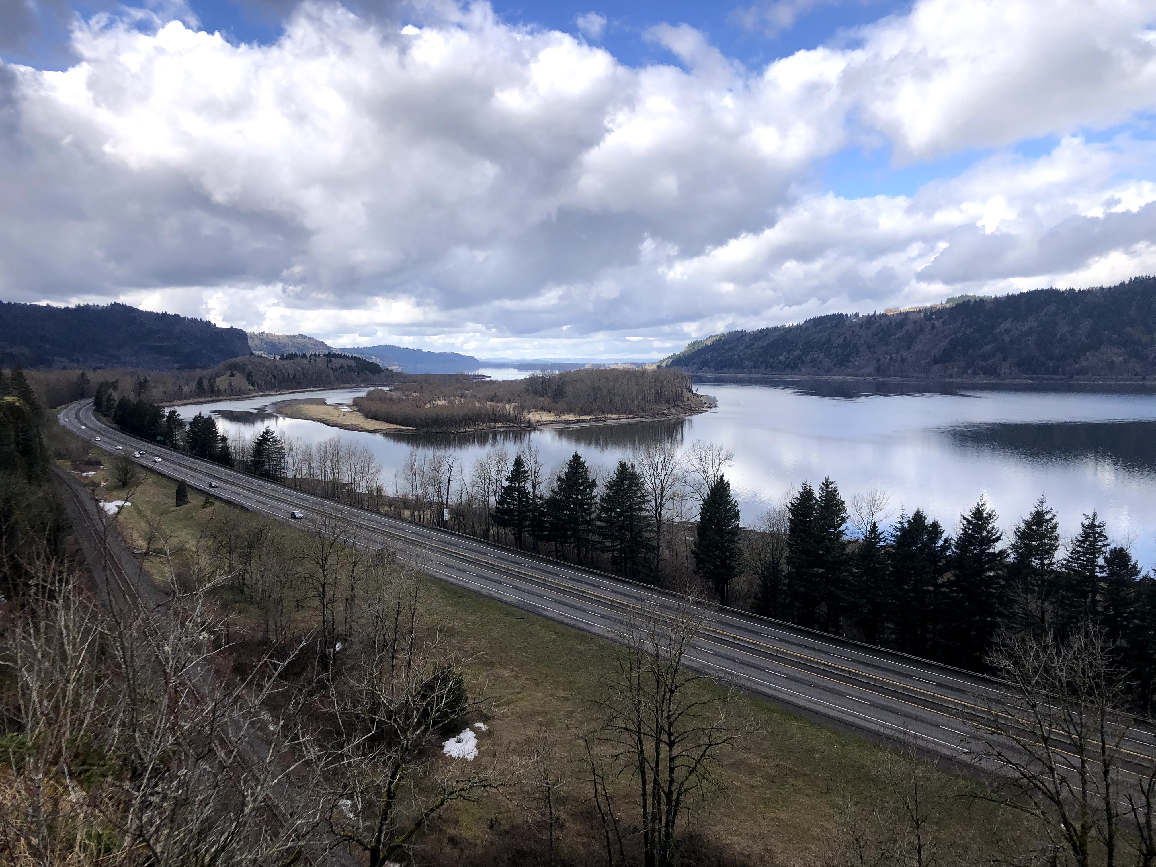
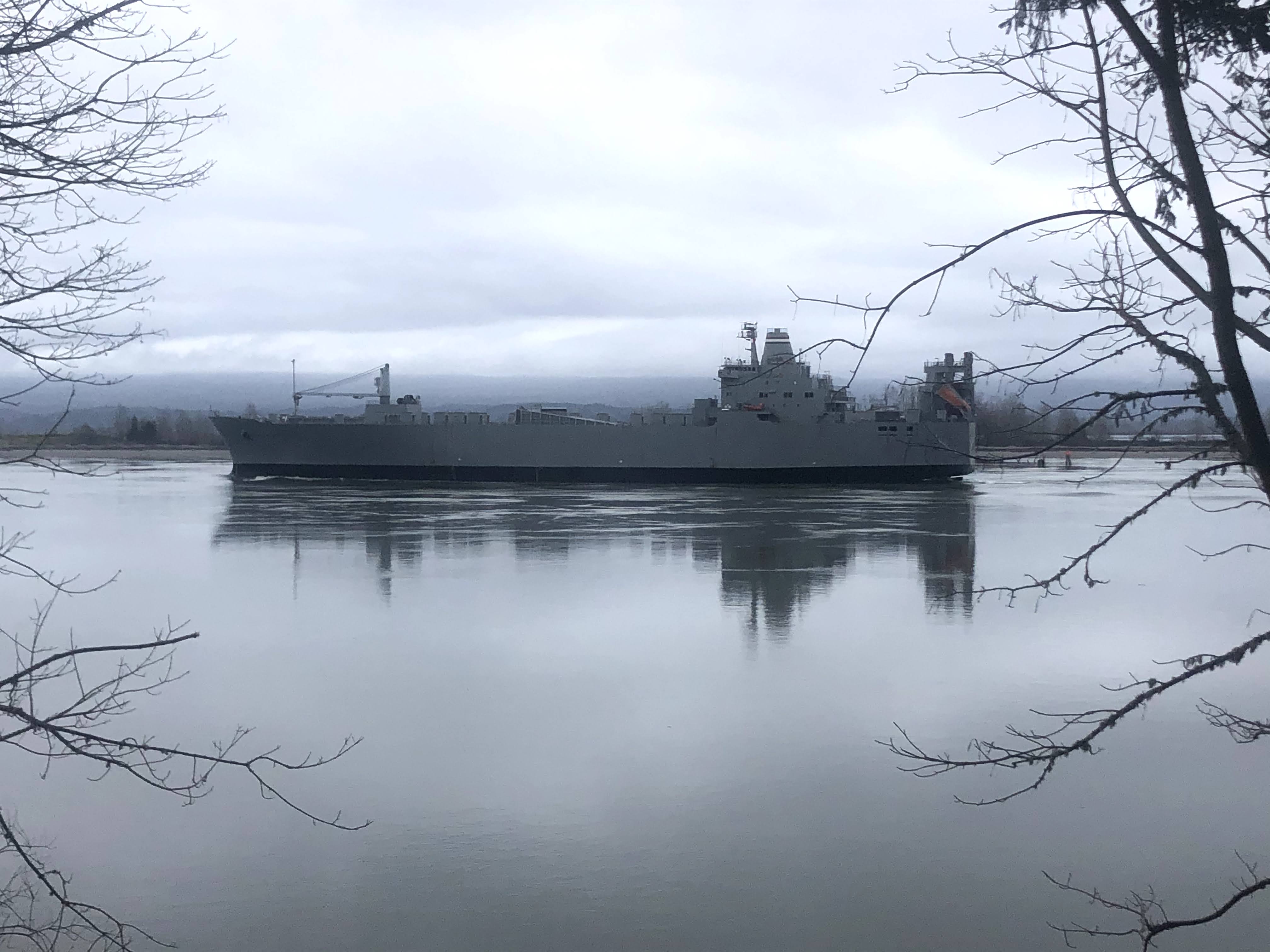
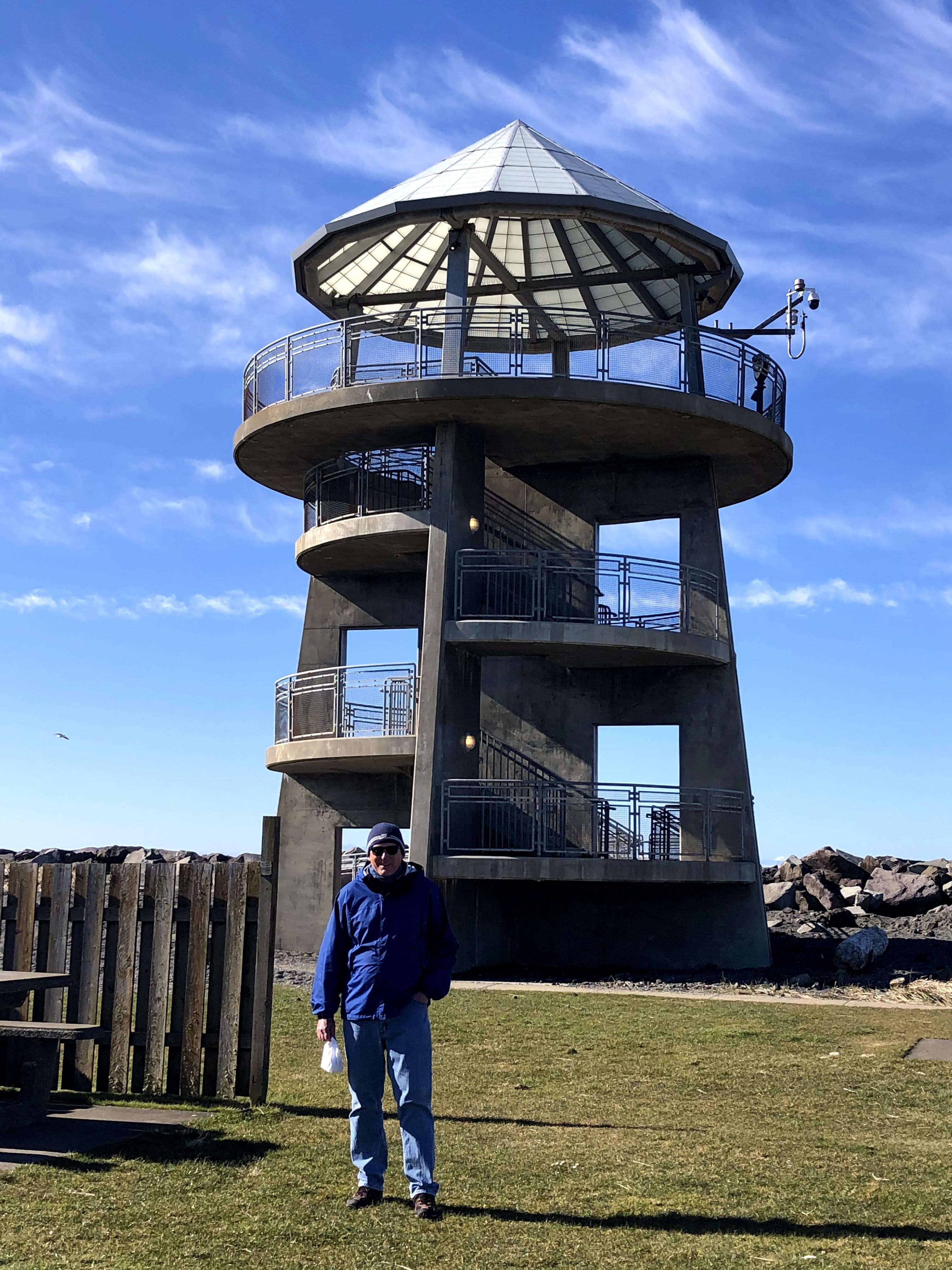
We finished up our time at the Coho Cabin in Rosburg a few days before we had originally planned.  We had spent Wednesday checking out the coastal town of Westport, which was about two hours away.  It was a long, but very fun day.  It was our last planned outing during our stay in Rosburg.  We were looking forward to spending the remainder of our time in Rosburg enjoying the cabin and river until our scheduled check out on Monday.  However, sometimes plans can change quickly and this was one of those times.

Me and the Bullet posing on Cohassett Beach, which is located just south of Westport.

Along the Westport Light Trail- a very nice 1.4 mile paved trail along the beach. 

There were several overlooks along the trail that offered great views of the beach, waves and surfers.

Gray's Harbor Lighthouse, Washington's tallest lighthouse.

Westport Viewing Tower-A great place to watch the fishing boats coming in and leaving the Westport Marina.  Also a great place to watch the huge waves that crash along the shore during the King Tides.


Westport Marina and Westhaven Dr, Westport's main street.

The Blue Buoy Restaurant is located on Westhaven Dr.  Good food and inexpensive too!


After Rosburg our plans were to go back to a place we've enjoyed several times before, Estes Park, Colorado.  From Rosburg to Estes Park is about a twenty one hour drive.  From Washington we would be passing through parts of Oregon, Idaho, Utah, Wyoming and into Colorado. When we lived in Texas we would often make the drive of a similar length to Florida and back nonstop.  We're not as young as we used to be and there isn't much of a schedule to adhere to anymore so we planned to make the drive in two days.

We knew that there was a big winter storm brewing that was heading for Colorado.  The more we watched the weather the larger the storm seemed to be growing.  Estimates of snowfall seemed to be growing not by inches but by feet.  Weather reports were predicting a possibility of up to four feet of snow.  In just a couple of hours we went from enjoying a beautiful sunrise on the Columbia River to being packed and on the road by 9:15 AM.  It was so hard to leave Rosburg and the Coho Cabin behind (Thanks Krista, Bill and Leon!), but we figured that we'd be better off being ahead of the storm rather than trying to navigate our way to Estes Park during or just after it.  Also, Beth's sister Cindy told her we shouldn't miss a once in a lifetime chance to experience a major snowstorm.  Onward into the storm we went!

We ran across this large herd of elk on an afternoon drive in Rosburg.

The Gray's River Covered Bridge located near Rosburg.  It was built by the H.P. Ahlberg family in 1905.  The family had property on both sides of the river and the bridge connected the properties.  Originally it was not constructed as a covered bridge.   The covering was added in 1906 because the planks were too slick for livestock to cross safely.


Sunrise on the Columbia River!

Our goal for day one of the drive was Twin Falls, Idaho.  Had we waited and left on our scheduled check out date we would have left Rosburg around 4:00 AM so we'd arrive in Twin Falls in time to check out the Shoshone Falls.  Unfortunately, given the late start leaving Rosburg, it was dark when we arrived.  Both the Silver Bullet and us needed some rest so we headed straight to the hotel.  It was a long drive, but there was some incredible scenery along the way that made it an enjoyable drive.

Day One along the road........La Grande, Oregon

A little further down the road............Baker City, Oregon

Day 2 of our journey to Estes Park was much like the previous day.  Great scenery, bad singing and the holy trinity of long distance driving trips; gas, bathroom and food, back in the car and keep moving.  Not quite with the same speed and precision as a NASCAR pit stop, but very efficient nonetheless.

Day 2-Along the road.........near Evanston, Wyoming.

The weather and road conditions were for the most part cooperative.  There was a little wind and about 10 miles on I-80 in Wyoming where there was a little ice on the road.  Beth happened to be driving when we hit this stretch of highway, so we were in good hands.

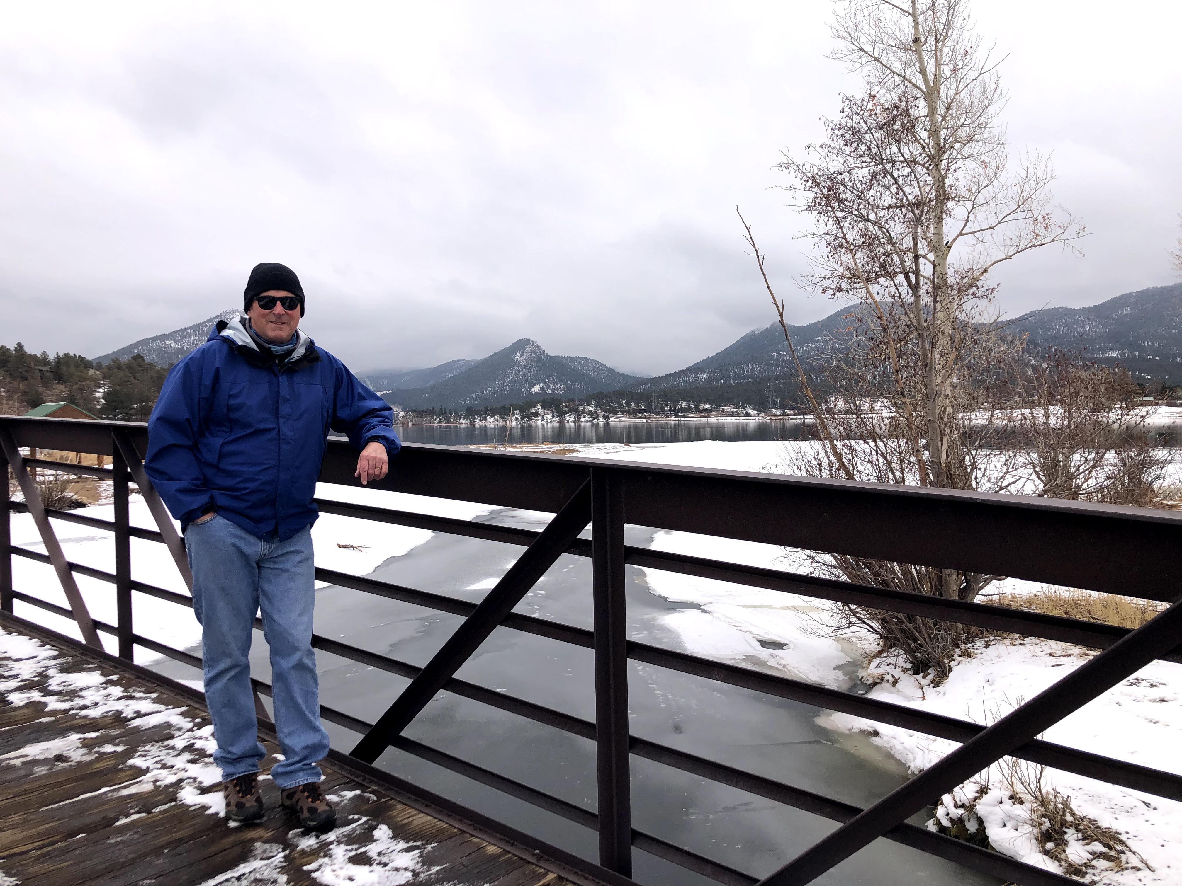
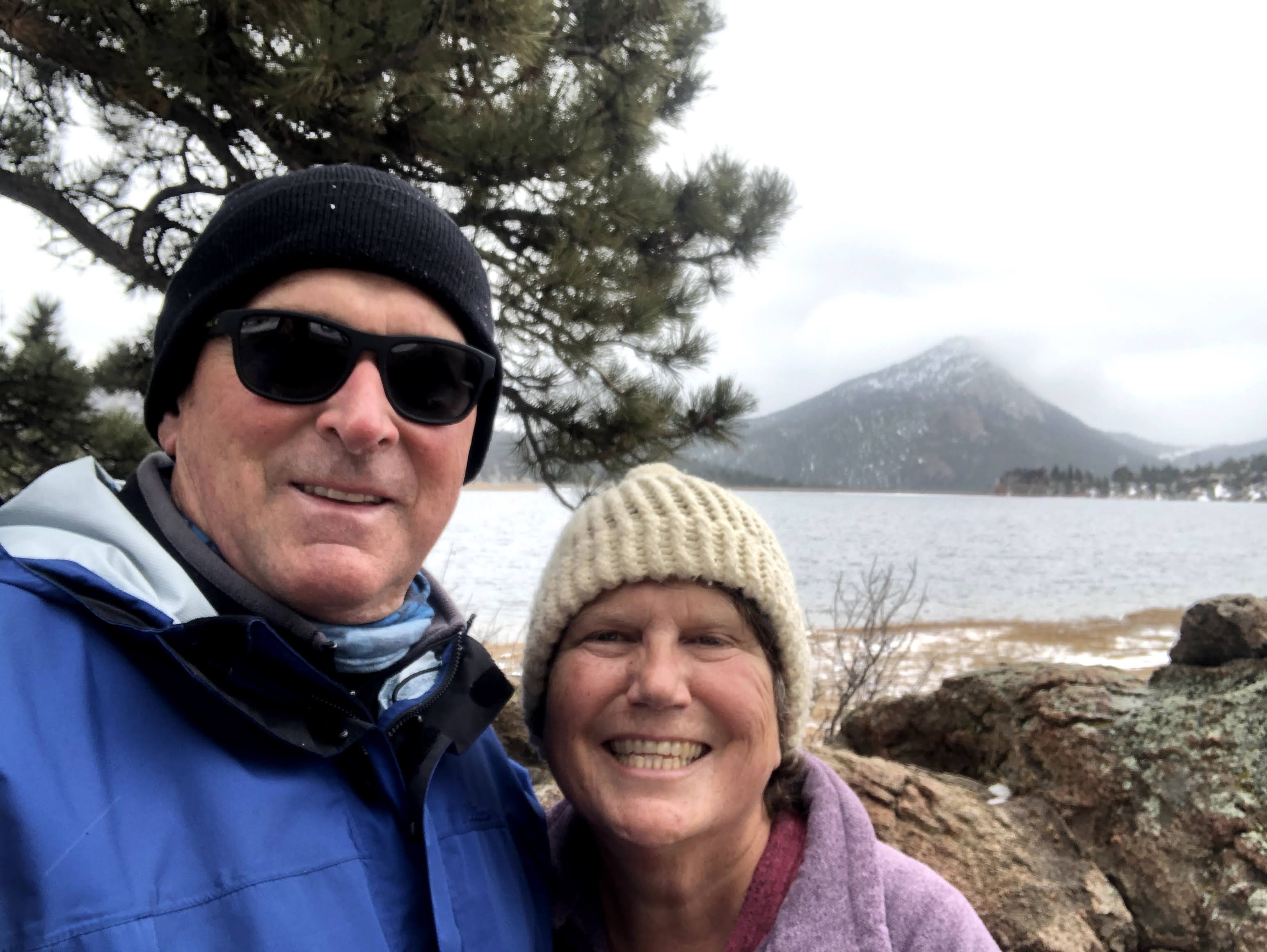
We arrived at Estes Park around 3:00 PM.  By 4:00 we had all the food unpacked, had found our bathing suits and were enjoying the hot tub.  We were unsure when the snow was going to start so we peeled ourselves out of the hot tub in time to make a twilight drive a few miles into Rocky Mountain National Park.  The park isn't crowded at this time of year.  The weather and the late hour in the day made it really empty.  I think it's fair to say we saw more elk than cars, which made watching three bull elk grazing near Beaver Meadows even more enjoyable.

It was just us, the Silver Bullet and these three Bull Elk late in the day in Rocky Mountain National Park.

This Mule Deer was so well camouflaged I almost drove by him. 

We woke up this morning to very light snow flurries so we decided to make another drive into the park.  The park service ranger at the entrance told us that the park would most likely be closing later in the day and that it may be closed for a few days.  We were happy to get one more drive in before the snow apocalypse.  We made note of where we were taking pictures. Assuming the weather people are accurate we hope to have some great "before" and "after" shots once the park reopens. 

We were able to enjoy walking the Lake Estes Trail before the snowfall picked up.  Here's a few pictures from along the trail.

Lake Estes Dam


The Stanley Hotel has been welcoming guests since July 4, 1909.  It is rumored to be haunted.


Did we make the right decision?  It's hard to know, but as I am writing this on Saturday afternoon, the snow is falling here in Estes Park.  Although the total snowfall amounts expected are dropping a bit, it's going to continue into tomorrow, so who really knows.  It's likely that parts of I-80 will be closed or at a very minimum driving would be slow and hazardous.  The fireplace is lit in front of us and the hot tub is about 25 steps away out the back door.  So yes, we're comfortable with our decision to leave, thankful for the memories of our time in Rosburg and looking forward to a return visit sometime in the future.

It was hard to leave Rosburg behind but Estes Park is a nice place to spend a few extra days!

We're also looking forward to having some very special family members join us on Wednesday!


Monday, March 8, 2021

Bridal Veil Falls, Cascade Locks, Hood River, Multnomah Falls and a retirees mistake...........


Soaking up the sun along the waterfront trail in Hood River, Oregon

"Time flies when you're having fun".  I guess we were really having fun at the Coho Cabin because when we got to thinking about it we hadn't cranked up the Silver Bullet in a full week.  Simply hanging around enjoying the solitude of the area, the river, beach fires, ship watching and the variety of wildlife in the river, on land and in the air kept us content. We had to do a double take at the calendar to confirm it had really been a week.  So we figured it was time to do a little more exploring of the Pacific Northwest.

We fired up The Bullet and headed south of the border for a full day adventure.  No, not to Mexico, but south of the Washington state line across the Columbia River and into Oregon.  Our destinations were all along the eighty mile stretch of the Columbia River as it passes through the Cascade Mountain range forming the Columbia River Gorge.

Columbia River Gorge

From Rosburg to our first destination, Bridal Veil Falls was a little over a two hour drive.  Rarely was the river out of sight.  First on our right as we traveled towards Longview, Washington, under us as we crossed over into Oregon and then on our left as we headed along I-84 into the gorge.  It was a very enjoyable drive and once we reached Bridal Veil Falls all of our other destinations were within 45 minutes.

Bridal Veil Falls

Bridal Veil Falls has two sections that appear to be close to the same height.  Thanks to the recent winter storms and rains there was plenty of water cascading over the falls.  With a little imagination, it looked like...........a bridal veil.  We enjoyed both short hikes from the somewhat small parking lot. The first one was a half mile loop trail on the ridge.  This flat, paved trail offered some great views of the Columbia River and several large waterfalls coming off the steep cliffs across the river on the Washington side.  The Falls View Trail was slightly longer and steeper but gets you very close to the base of the falls.  I learned that there is a post office near the falls that is named Bridal Veil Falls.   Engaged couples looking for the complete wedding experience ship their wedding invitations here for mailing so their wedding invitations show the post mark is "Bridal Veil Falls".  I  don't want to rain on their parade or take away any business from the Bridal Veil Falls Post Office, but I doubt too many people pay attention to the post mark.

Taken from one of the viewpoints on the loop trail at Bridal Veil Falls.  Looking across the Columbia River to waterfalls on the Washington side of the river.

From another viewpoint on the loop trail.  The highway is I-84.  It was built in the 1960's to replace the Historic Columbia River Highway that opened in 1915 connecting eastern and western Oregon.

Bridal Veil Falls

Along the slightly steep, slightly muddy Bridal Veil Falls Trail.

After a picnic feast (love that chicken from Popeyes), which we backtracked a little to enjoy, it was on to the small city of Cascade Locks.  The city got it's name from a set of locks that were built there in the late 1800's to improve navigation on the river.  It must have been a challenging project.  Construction began in 1878 and wasn't completed until 1896.  After the long construction period, the locks use was somewhat limited and in 1938 they were taken out of service.  What remains is a very scenic and historic small town with a population of a little over 1,000 people and one main road running through it.  There is a really nice marina park with a connecting bridge over to a small island known as Thunder Island which offers great views of the Bridge of the Gods.  In the park there is a small historical museum that unfortunately is closed at the present time (not sure if it's covid related or seasonal).  We have a somewhat interesting connection to the museum.   It's director is the daughter of one of Beth's good friends from way back when we lived in Port Charlotte, Fl..  Oh yeah, Beth and I were younger back then as well!

Cascade Locks Historical Museum

Bridge of the Gods.  The bridge opened in 1926 connecting Cascade Locks to Skamania County, Washington.  In 1927 Charles Lindbergh flew the Spirit of St. Louis over the bridge, made a 180 degree turn and flew under the bridge before heading back to the Portland Airport.

Looking up river from Thunder Island in Cascade Locks.


Next up was Hood River, which was our turn around point for this day's adventure.  Hood River is along the Columbia River but is appropriately named.  The city, which has around 10,000 residents is located at the confluence of the Hood and Columbia Rivers.  We had visited Hood River many years ago and enjoyed watching the windsurfers and kite surfers on the river.  We could see a few kites in the distance as we walked along the waterfront but at this time of year I'm sure participation in those activities is somewhat limited.

Hood River Marina with the creatively named Hood River Bridge in the background.

That's a long time to "hold it"!


The last stop on our Columbia River Gorge Day Trip was a stop at the very impressive Multnomah Falls.  This waterfall is so conveniently located to I-84 that the parking area is actually in between the east and westbound lanes.  From the parking area there is a short tunnel under the highway that takes you to the base of the falls.  Like Bridal Veil Falls, there are two sections to Multnomah Falls.  The combined drop of the two sections of the falls is 620 feet, with the longest drop being 542 feet.  At this height, Multnomah Falls is the tallest waterfall in Oregon. 

This is the top section of Multnomah Falls........Oregon's tallest waterfall.

This photo shows both the upper and lower sections of Multnomah Falls.  There is a 2.4 mile trail to the top of the falls.  Due to slippery, slushy conditions on the trail we only walked to the bridge.

The recent rains and snow provided plenty of water for us to enjoy watching fall into the pools and streams below.  The last time Beth visited Multnomah Falls was on one of her "old lady trips" with her mom and two sisters.  It would have been in the early fall and she told me that while the waterfall was beautiful both times, there was much more water flowing this time.

It was a long day, but a fun day nonetheless.  We arrived back at the cozy confines of the Coho Cabin just as the last rays of sunlight were fading away.  A little tired but very happy for the time we had spent in the Columbia River Gorge.

Now about that retiree mistake.  I'm rapidly approaching the five year mark as a retiree.  Time of day and day of the week have become pretty much irrelevant.  Before we headed out, we really didn't think about the fact it was the weekend.  That, combined with pleasant weather and the gradual  lifting of restrictions related to Covid made for somewhat large crowds.  Nothing was over crowded and it was certainly manageable but there's a good chance that if we had gone on Friday or waited until today (Monday) we would have had most places to ourselves.  Also, we would have been able to get an ice cream treat at the Eastwind Drive-In in Cascade Locks.  There were a couple of dozen cars lined up both times we passed.  It must be really good.  We'll have to come back sometime!  

While writing this blog the fully loaded bulk carrier CL Tianjing passed by heading for the Pacific Ocean.  Next stop, Tianjin Xingang, China.  Ship watching is addictive!


Thursday, March 4, 2021

Blue skys, beach fires and watching the ships sail by.......................

The Pillar Rock Salmon Cannery is located on the property where we are staying.  Leon (The Mayor) is the father and father in law of our Airbnb hosts.  He has done an amazing job preserving the cannery through the years.  In addition to the moon in the upper left corner, if you look very closely on the right hand side just above the last piling, just above the tree line is Mt. Saint Helens.  The mountain, which is around 70 miles away erupted on May 18, 1980.  Fifty seven people were killed, 250 homes were destroyed and damages totaled over a billion dollars.

Since our trip to Astoria on Saturday the Silver Bullet hasn't moved an inch. We've been hunkered down here at the cozy Coho Cabin.  This hasn't been out of necessity, but strictly by choice.  We've been able to enjoy some quality beach time for four consecutive, rain free days.  Yes, it was still a bit chilly so I didn't break out the speedo bathing suit.  For the most part a jacket was still required, but with temperatures in the mid-fifties it was downright pleasant, especially with a fire on the beach to help keep the chill away.

Pre-Dawn (5:58 AM)-The Columbia River under a full moon.

Sunrise (6:40 AM)

Sunset (6:08 PM)........all on the same day!


Our location here in Rosburg is about fifteen miles up river from where an average of 265,000 cubic feet/second of water flows into the Pacific Ocean.  It is a tidal area, and the tides here are pretty significant.  The river rises about eight feet between low tide and high tide.  What this means for us is that at low tide we're able to enjoy a nice wide beach that slowly but completely disappears as the tide comes in.  Low tides have been occurring around mid-day, giving us plenty of beach time between the early morning and late afternoon high tides.

It's about an hour until high tide.  The large log on the right side that is about halfway in the water is our picnic table (see Feb. 21 blog). 

Fires are allowed on the beach here and firewood is not a problem.  There's plenty of cut firewood at the cabin (thanks Bill) and an endless supply of driftwood along the beach.  The beach driftwood is replaced with every passing high tide.  Additionally, there is no reason to worry about forest fires thanks to the green rainforest like conditions and the fact that the incoming tide will douse any beach fire as it comes in.

The incoming tide is about to put out our beach fire!

While the beach fires are joint efforts, Beth is both the CFS (Chief Fire Starter) and keeper of the flame throughout the day.  We've been well intentioned and taken our books down to the beach with us every day, but we've yet to turn a page.  There's simply too much to take in.  There's sea lions, seals, eagles and river otters to spot.  We also enjoy just sitting quietly and contently staring out at the water or strolling along the beach gathering firewood to feed to the flames.  

The Chief Fire Starter and Keeper of the Flame

Adding fuel to the fire!

In addition to all the nature there are the occasional passing ships that we enjoy watching.  Unless the Columbia River Bar is closed, there are about a dozen ships per day that navigate their way upstream to ports and downstream to the ocean through the 45-80 feet deep channel.  We learned from information provided in the cabin that not only can these ships be tracked in real time but information is online that tells where the ship is coming from and where it's going.  

This is actually a US Military Ship.  It's listed as a Ro-Ro Carrier.  Ro-Ro means the cargo rolls on and rolls off the ship.

A loaded (it's sitting low in the water) Bulk Cargo Ship heading for Japan

I'm not sure of the name of this vessel located on our beach..........maybe SS Better Days?

An empty bulk carrier heading up river to port

I still don't quite understand the physics regarding water displacement well enough to completely comprehend how that many tons of metal can stay afloat.  What I do know is that they are marvelous engineering masterpieces to look at and it's made even better by having insight into where they've been and where they're going.

As I was diligently typing away on that last paragraph I looked up to see the Artemis Bulker cargo ship passing by heading into port up river.  Just in case you were wondering, this 656 foot long ship, weighs in at 35862 tons and was traveling at 10.2 knots as it passed by just a few miles away from ending a journey it started in Pohang, South Korea on February 13.

If you're near a port this is a fun app to use.


My view while blogging..........its slightly distracting!

With so many sights to behold, it's no wonder we haven't gotten much reading done!