Saturday, September 14, 2019

Crusing Highway 101.........Bandon, OR to Trinidad, Cal

A talking Paul Bunyan and Babe the Blue Ox at the entrance to the "roadside attraction" Mystery of the Trees.  We resisted the temptation to go in.

U.S Highway 101 runs north and south through the states of Washington, Oregon and California.  If you drove it from end to end you'd cover 1,540 miles.  It would be fun to drive it the whole way, but that's for another time.  Our journey for the day (Wednesday) was just a little over 10% (169 miles) of the total length, taking us from Bandon in southern Oregon to Trinidad in northern California.
According to google maps the drive time is just a little over three hours.  However, when you're on a drive as spectacular as this one, time is irrelevant.  There were numerous stops along the way to take in the scenes along the rugged coast line as well as in several of the small towns we passed through..  By the time we arrived in Trinidad we had been driving and stopping for over six hours.  A nice day of cruising along the highway.

Face Rock in Bandon

Port Orford, Oregon  The westernmost incorporated place in the 48 contiguous states.  The marina is one of only six "Dolly Docks" in the world.  The harbor is too shallow for boats to safely dock in the water.  All boats (commercial and private) are hoisted into and out of the water everyday.  This boat is being lowered into the water.

Gold Beach-There are only a few boats in the marina.  There were hundreds drift fishing for salmon in the river.

Thomas Creek Bridge-the highest bridge in Oregon.  It's 345 feet from the surface of the bridge to the valley below.

The Redwood Trees along the Oregon and California coast are over 200 feet tall and can live up to 2000 years. 

Part of a large herd of Elk.  There were a couple of Bull Elk in the background but they seemed camera shy and stayed in the bushes.

Our "home" at the end of the day.  Emerald Forest Cabin

Trinidad Memorial Lighthouse


Tuesday, September 10, 2019

Bandon and Coos Bay

Sharing Bandon Beach with some of our rock friends

On our way out of the Union Creek area we made a quick stop to do a short hike that I had read about the night before.  We debated if we were going to do it or not before deciding to go for it, and we're glad we did!  The hike took us to two amazing waterfalls, Mill Creek Falls and Barr Creek Falls.  Both waterfalls were about the same height (Mill Creek was listed at 175 feet) and only a few hundred feet from each other.  The Mill Creek Falls was a straight drop, while the Barr Creek Falls cascaded down several steps before reaching the bottom.  It was a great way to start the drive towards the Oregon coast.
Mill Creek Falls

Barr Creek Falls

We're spending two nights in Bandon, which is part of the Southern Oregon Coast.  As you've probably figured out by now if you've followed the blog, we're big fans of being on the ocean.  Of all the coastlines we've visited all over the world, there really aren't any we haven't liked, but the rugged Oregon coast is one of our favorites.
Bandon is a typical laid back coastal Oregon city.  It has a population of just over 3,000 and an economy that is built mainly around tourism, fishing and lumber.  Our hotel, Windemere on the Beach is just south of town and as the name implies is located directly on the beach.  We arrived a little before noon and were not disappointed to learn that our room wasn't ready yet.  We simply left everything in the car and headed down for a walk along the shore.  It was about 60 degrees with a 15-20 mph wind blowing off the ocean, making it refreshingly chilly!
As with many of the Oregon coastal beaches, this one has large, interesting rock formations some of which are in the water during high tide and are a part of the beach itself at low tide.  When the tide is low there are often small tidal pools that form around the base of these rocks.  It's certainly different than the Florida coast line we're used to and most coast lines we visit.


Downtown Bandon has a section called "Old Bandon" that is built along the bay front.  There are a number of shops and restaurants and even a few playful seals swimming around just off the boardwalk.  We had a really good and inexpensive (which makes it even better) meal at the Bandon Fish Market.  Great clam strips and clam chowder for not a whole lot of clams!

Good Clams!

Rainbow over the Bandon Marina


There is a very interesting looking museum in Old Bandon called "Washed Ashore".  All the art is made out of plastic that has washed up on the Oregon beaches.  It's purpose is to raise awareness of what we are dumping into our oceans.  Unfortunately the museum is closed on Monday's and Tuesday's.  This was one of two pieces on display outside the museum.

Another "Washed Ashore" display

We finished the day with a sunset stroll along the beach.  The sunset itself wasn't spectacular but the clouds and rain just offshore made it quite interesting looking and Beth got some really nice photos.


Today we headed 20 miles north of Bandon to the Coos Bay area.  We enjoyed visiting Shore Acres State Park.  This park is located right along the coast and has some great overlooks of the Pacific Ocean as well as a nice botanical garden.  Although we were a little bit challenged by the rain,  we really liked the Simpson Reef Overlook.  Huge waves were crashing over the offshore reef and what seemed like hundreds of seals and sea lions were playing in the surf and resting on the rocks.
On our way back to Bandon we stopped in the city of Coos Bay for lunch.  Yesterday it was the Bandon Fish Market, today it was the Fisherman's Seafood Market.  Again, it was inexpensive and very tasty.  More clam chowder but this time served with a mix of fish and chips and shrimp and chips.  So much good seafood, so little time!
Simpson Reef Overlook @ Shore Acres State Park

The Botanical Gardens

There was a small Japanese Garden inside the botanical garden


A delicious lunch served on the water!

As we were leaving Coos Bay a mural in downtown caught my eye.  I recognized the subject of the mural immediately, it was the great runner and Coos Bay native, Steve Prefontaine, affectionately known as "Pre". In the early 70's, at a time I was doing a little bit of cross country running in high school, "Pre" was setting new American records at every distance from 2,000 to 10,000 meters.  He was as fierce a competitor as there ever was and an outstanding "quote machine".  A couple of his more famous quotes were, "to give anything less than your best is to sacrifice the gift" and "somebody may beat me, but they are going to have to bleed to do it".    He, along with Jim Ryun, Frank Shorter and Bill Rodgers were credited with carrying the torch for the "running boom" of the 70's. Sadly he passed away in a car accident in May, 1975 at just 24 years of age.  The mural is a great tribute to his legacy.
Honoring Coos Bay's Hometown Hero

Once we got back to our hotel we did a nice long afternoon walk along the beach.  It was low tide so we were able to explore a small cave through one of the larger rocks as well as several tide pools.  Tomorrow morning we are heading back to California for a one night stay in Trinidad before going on to Fort Bragg/Mendocino coast to meet up with the Martins!
One of several small caves that we explored during low tide

Sea Urchins in a small tidal pool

The Coquille River Lighthouse in Bandon
Bandon from the inlet

Clam diggers at low tide

I'm certainly no expert on the Oregon coast.  There is much more of it that I haven't seen than that I have seen, but I can say without a doubt it's pretty darn nice! 

Crater Lake......it's out there somewhere!

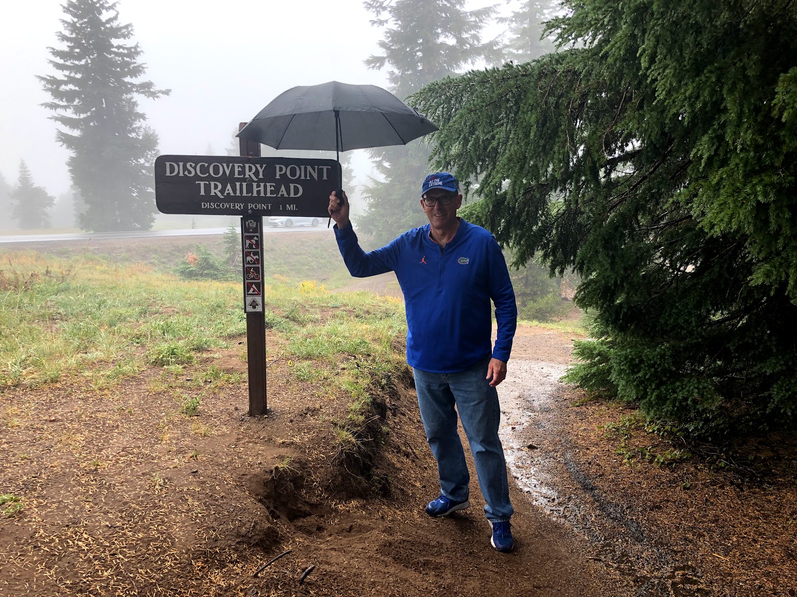
Discovery Point on the rim of Crater Lake........or at least that's what they told us!

After leaving Lassen Volcanic National Park we drove about 30 minutes to the small town of McCloud.  Our hotel for the night was at the Shasta View Lodge.  The lodge is appropriately named because it offers a great view of the 14,179 foot Mount Shasta.  The mountain is listed as a "potentially active" volcanic mountain.  Thankfully, there was no activity while we were there.
The parking lot of the Shasta View Lodge was full when we arrived.  The lodge is small, with only seven rooms.  It also has a restaurant that was doing a brisk business.  After checking in at the restaurant bar, to what was a surprisingly nice, large room we headed back to the restaurant to see why it was so popular.  The patio tables were packed, so we had to settle for the last inside table.  The food was excellent and the portion was large enough that we split one entrée and still didn't finish it.
Shasta View Lodge
Our Sunday destination was Crater Lake, which was about a three hour drive.  Once again most of the drive was on the Volcanic Legacy Scenic Byway, and again the drive lived up to it's billing as scenic.  As we drove, we crossed over from California into Oregon.  It was obvious that we were climbing much of the way.  It was also obvious that it was becoming chillier and cloudier outside.
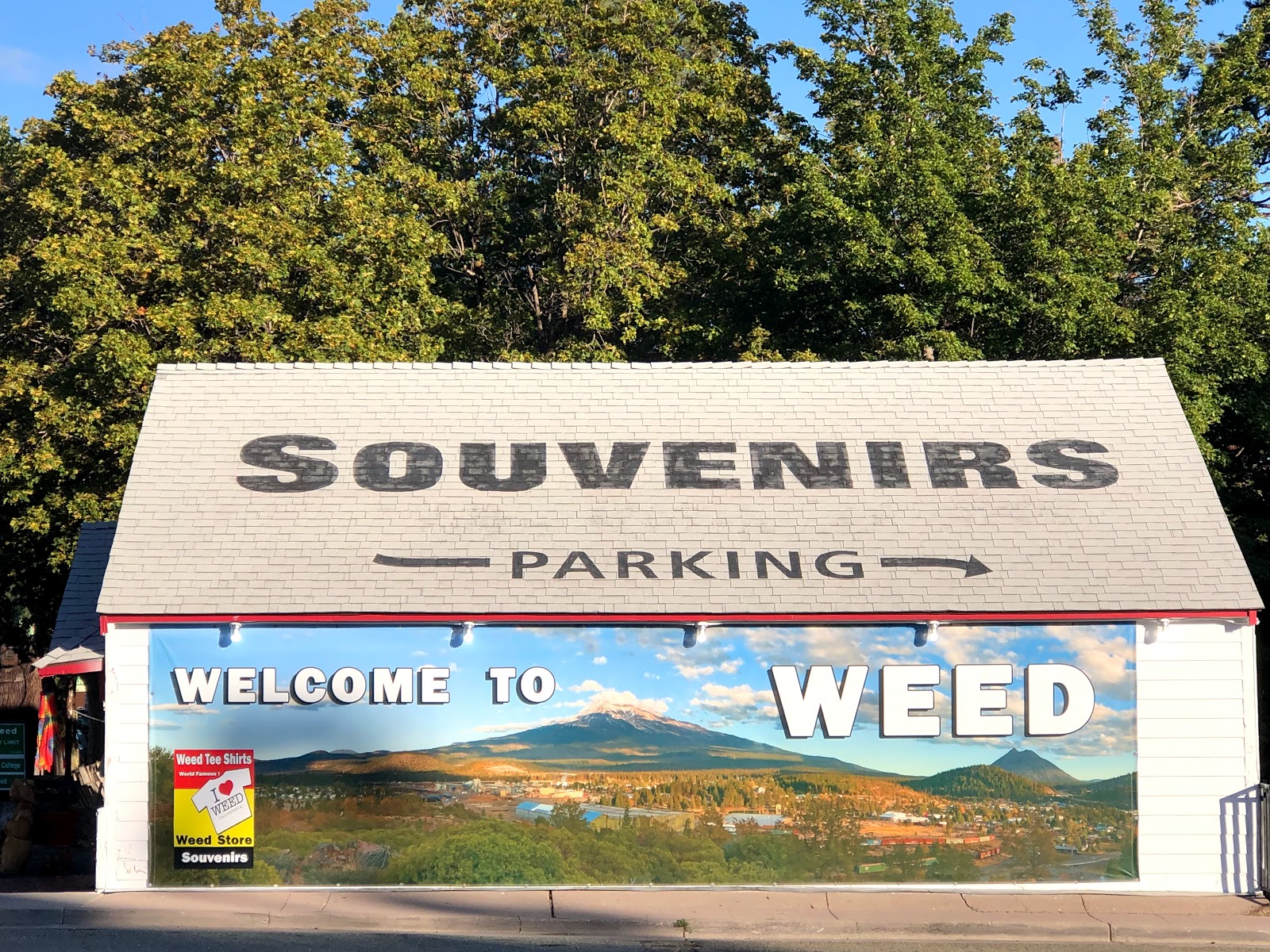
The drive from McCloud to Crater Lake took us through the town of Weed, California

We arrived at the entrance to Crater Lake National Park to a temperature in the low forties, fog, drizzle and occasionally rain.  A few degrees colder and it would have most likely been snowing. The park averages over forty four feet of snow per year, making it one of the snowiest places in the US.
The visitors center had a very informative twenty two minute movie on Crater Lake that focused on the lakes formation.  The lake actually started as a volcanic mountain that was estimated to be in the 14,000 foot range.   It erupted some 7,700 years ago with such force that the pressure change under the mountain caused it to collapse in on itself.  The end result of this massive eruption, along with thousands of years of snowmelt, was the formation of what is now known as Crater Lake.
Crater Lake National Park!  That's a "snow pole" behind us.  It must be quite a site to see when the snow is that high. Sunny at this point.

In addition to how it was formed there are several things that make the lake unique and such a popular spot to visit.  The lake is located at an elevation of just over 6,000 feet, making it slightly higher than the mile high city of Denver.  There is an island in the lake called Wizard Island.  At it's widest points the lake is just over 5 by 6 miles wide. But the most unique feature of the lake is the clarity of the water.  Because there is no flow of water into or out of the lake it is considered some of the purest and clearest water on the planet.  The water clarity has been measured to a depth of 143 feet, which is the greatest depth of clarity ever recorded anywhere!
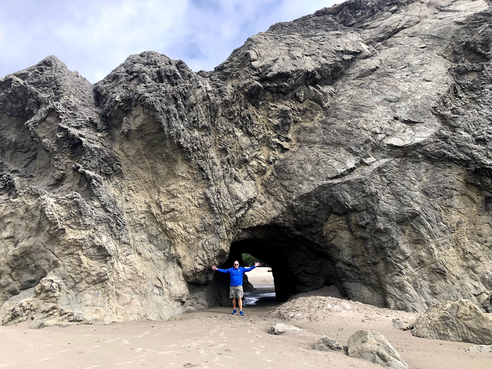
After filling our brains with all this knowledge it was time to pay the lake a visit and take in the wonder of it all with our own eyes.  It was a few miles drive to the rim of the lake and we had in mind hiking the short (just over two miles) Discovery Point Trail.  The trailhead for this hike is at Rim Village and turns around at Discovery Point, which is said to offer the best view of both the lake and Wizard Island.  The good news was that we pretty much had the trail to ourselves.  The bad news was that we had the trail to ourselves because of the rain, clouds and fog.  As we hiked we would occasionally catch a brief glimpse of the lake.  At one point we passed a group of hikers who were excited because they had been hiking all morning and they had just caught their first glimpse of the lake.  At Discovery Point we discovered that on a super cloudy, foggy, and rainy day that there isn't much to discover.
A few shots from along the Discovery Point Trail


A brief glimpse of the lake.  You can barely make out Wizard Island below my arm.

We were a little disappointed on the hike back.  Especially me, since this was my first visit, but mother nature is going to do what she's going to do, when she wants to do it.  After warming up a bit in the café and gift shop we headed to the lodge located nearby.  The Crater Lake Lodge is one of the classic style national park lodges similar to those in many of the famous parks such as Yellowstone.
Because of the less than ideal weather outside, the lodge was crowded, but we found a couple of seats on one of the couches.  Suddenly, magically, mysteriously we pretty much had the lodge to ourselves as everyone headed for the back exit.  Not ones to be left out of the action, we headed out ourselves to discover that the clouds, fog and rain had disappeared and the entire lake was now visible.  It was truly a site to behold.  We, mainly Beth, since she is the better photographer snapped a few pictures but we mainly stood there and enjoyed the spectacle of Crater Lake, knowing that it was most likely going to disappear as quickly as it appeared.  After around 30 minutes we decided to do the drive around the lake, which typically takes a couple of hours because of stops.  We were about 10 minutes into the drive when the clouds, fog and rain rolled back it.  We were satisfied with what we had seen and headed towards our hotel, the Union Creek Resort near the small community of Prospect.
It was a good day even before the lake came into view!


Wizard Island

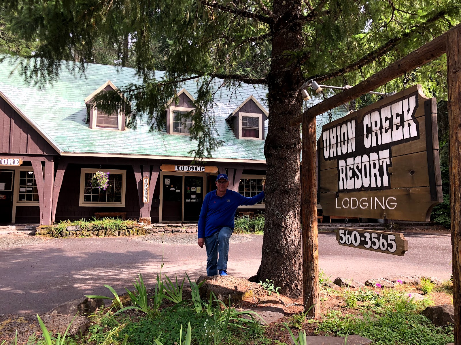
True to it's word, the Union Creek Resort is located right beside Union Creek.  A more accurate description might have been Union Creek Rustic Resort.  The accommodations were clean, cozy and comfortable, but a little bit on the rustic side.  There are around 30 cabins and additional rooms in the lodge.  We stayed in a lodge room which was all that was available at the time we booked it.  It wasn't bad at all, but as with many places in this area, the wifi was spotty so I've gotten a little behind on the blogging.  Past guests have included author Jack London and President Herbert Hoover, who knows maybe they stayed in Lodge Room 207 as well!
The original lodge burned in 1937.  It was quickly rebuilt and the one I'm standing in front of opened in 1938.

On the grounds of the lodge is the equally famous Beckie's Café, which has been serving up "home cooking" and world famous pies since 1926.  The food was really good, but if you go, make sure you leave enough room for a slice of pie (with ice cream, of course).  They offer a wide variety of pies but are most well known for their Huckleberry Pie, which is a seasonal pie.  Thankfully, huckleberries are in season and they hadn't sold out for the day.  It was overflowing with huckleberries and absolutely fantastic!
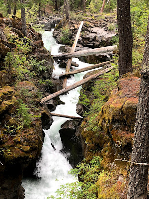
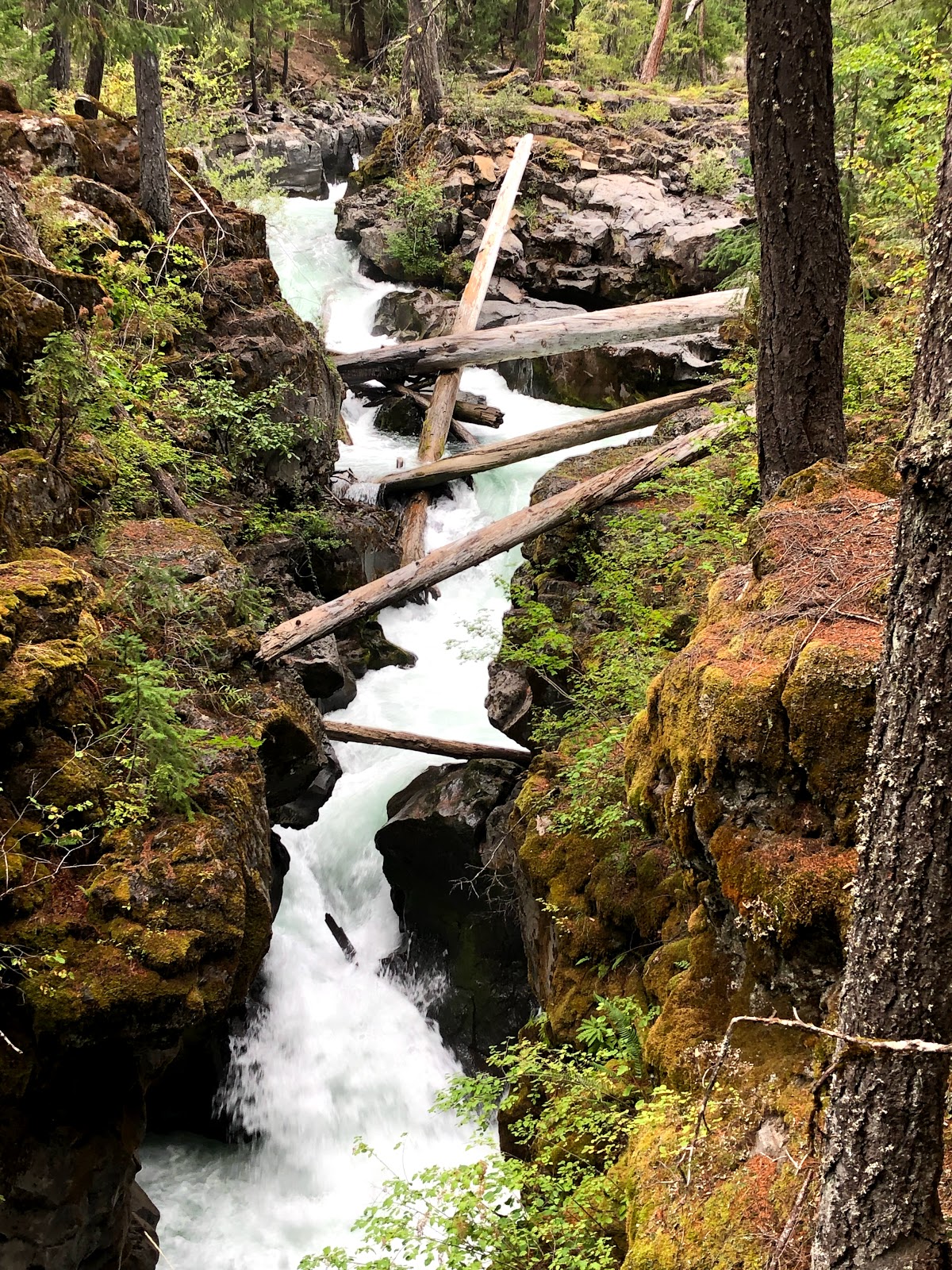
This is the Rogue Gorge Near Union Creek Resort.  It's a very short hike along the gorge rim.
The Natural Bridge is another short hike near Union Creek.  The water from the river actually disappears into a lava tube for about 200 yards.  Water is flowing beneath this "bridge"
Union Creek Resort and Beckies Cafe
Both the Union Creek Resort and Beckie's are on the National Register of Historic Places


Save room for some pie!