Friday, June 21, 2019

Easter Island-Day 3........The Birdman Competition

Hola from HareSwiss Bungalow #2

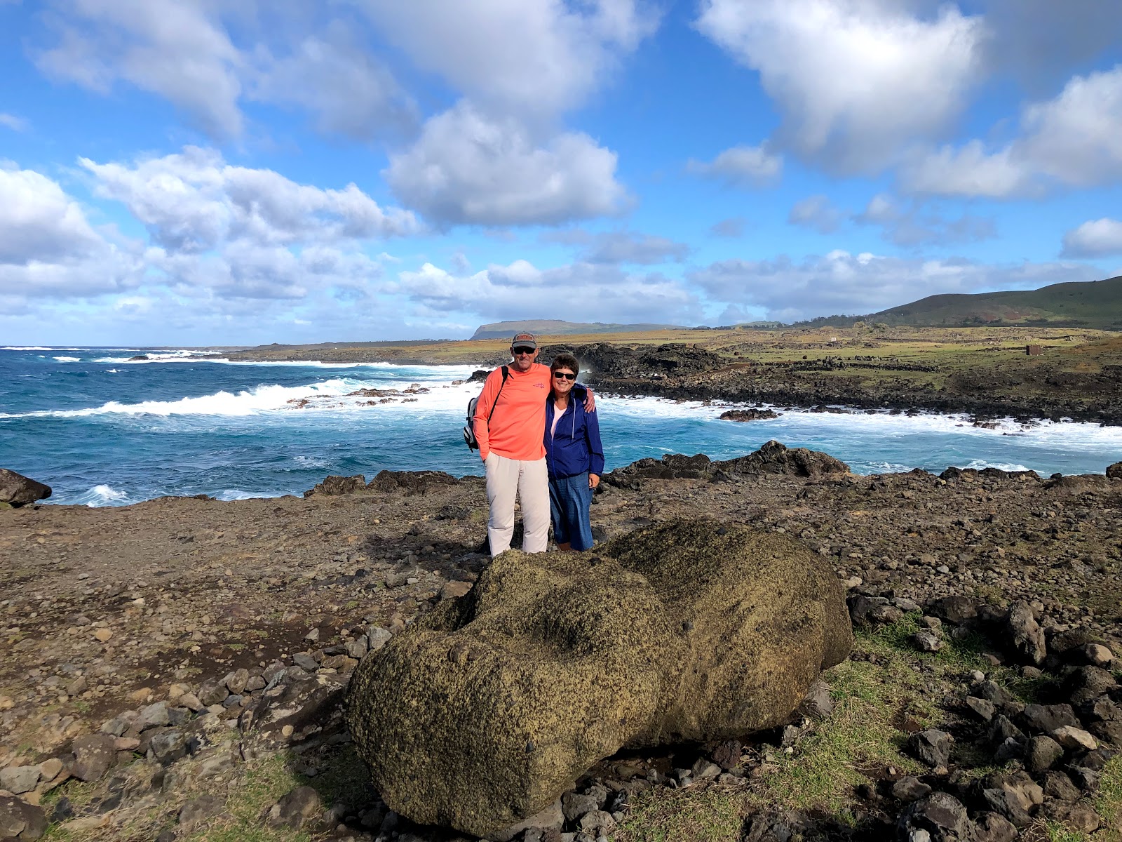
Yesterday was a combination of relaxing and exploring.  In the morning we enjoyed the simple pleasure of taking it easy.  There was a little bit of reading, a little bit of staring out at the ocean and
for me a little bit of napping.  A bit of our reading was in preparation for the afternoon of exploring.  Much of the information in the blog below, including the Birdman Competition came from a very nice book titled "A Companion Guide to Easter Island".  It was written by James Grant-Peterkin.  It's a nice combination of travel guide, and history of the island, that is written in an easy to read and entertaining format.  I'm also a sucker for trivial information, so here's a few morsels of information on the Easter Island airport I found in the book.
First of all, my good friend Ed Laue and I were texting yesterday.  Ed's quite a scholarly gentlemen so in addition to texting he was looking at a map of Easter Island.  He shared with me that given the location of the airport that it looked like the runway ran the width of the island.  He was pretty accurate in his observation.  Where it is situated there isn't much land on either end of the runway.  There is however a few thousand miles of ocean if a water landing becomes necessary.
The first runway on Easter Island was built by the US military during the Cold War with Russia in the 60's.  We placed around 100 troops on the island along with satellite tracking (spy) equipment.  In 1970 Chile elected as socialist president, Salvador Allende, who had strong ties to Russia and Cuba.  Shortly after the election our troops were expelled from the island.  Leaving behind the island's first runway and a few diesel generators.
In the 90's a passenger plane from Santiago was flying to Easter Island.  It had long passed the "point of no return" where it would have enough fuel to make it back to the mainland.  Suddenly there was a power outage on the island and the airports backup generator failed.  I'm not sure if it was one of the generators our troops left behind or not.  I do know that landing a plane on a dark island in the middle of the Pacific Ocean would have been a challenge.  A call to the citizens of the island went out urging them to bring their cars and motor scooters to the airport.  They lined the runway, turned on their lights and the plane safely landed.  I assume a new backup generator was ordered quickly thereafter.
The runway was lengthened and the Concorde landed here on "Round the World" Charters operated by both Air France and British Airways.  And the final trivial fact about the airport...…….it was designated as an "abort" landing site for the Space Shuttle.  Thankfully it was never used for this purpose, but if the astronauts on board had any idea how cool Easter Island is, they might have tried to land here.
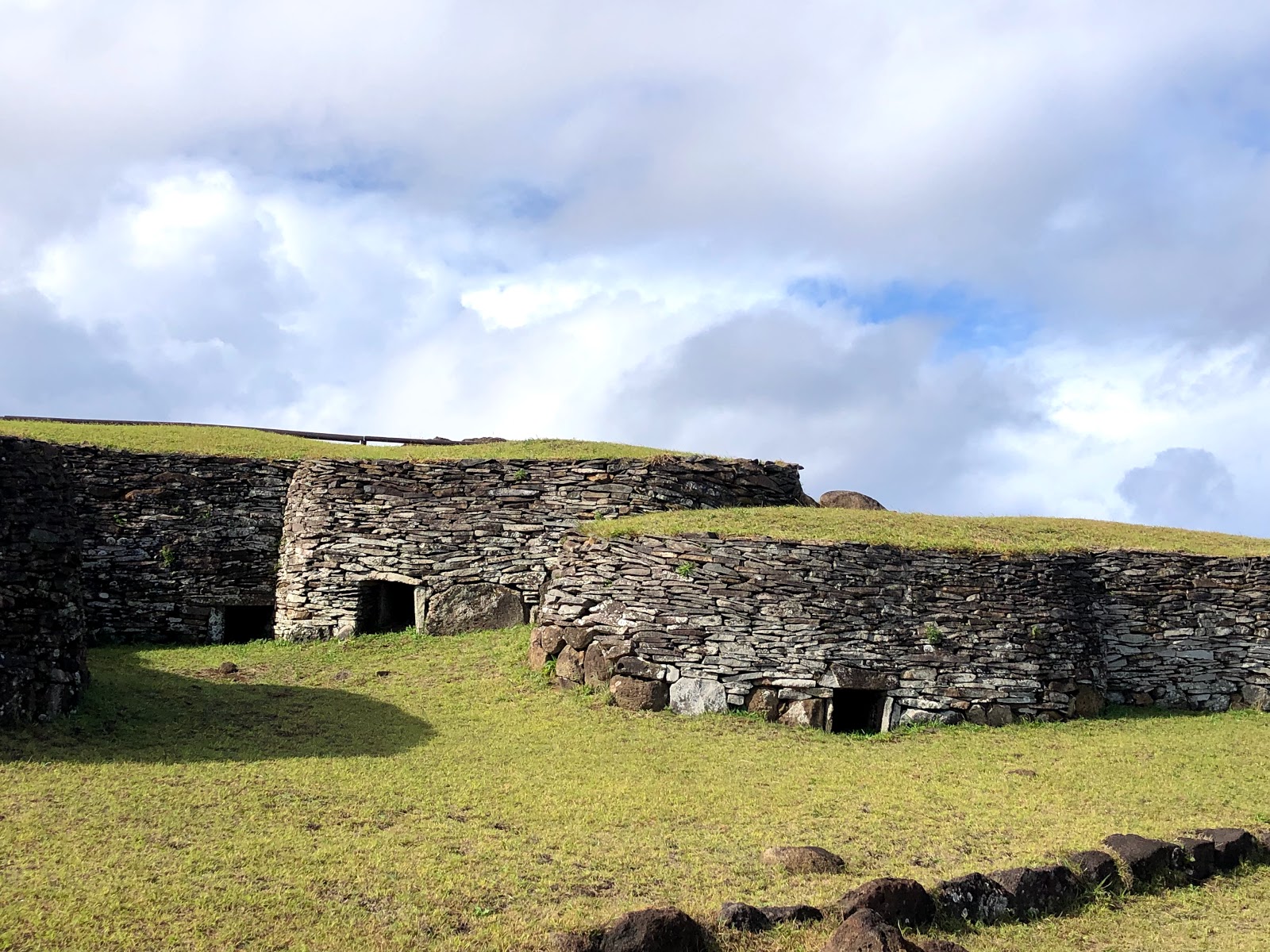
In the afternoon we rented a car and did a little exploring on our own.  We had a couple of destinations in mind that were quite interesting.  First up was Orongo, a ceremonial village perched high up on the rim of the extinct volcano, Rano Kau.  Deep on the floor of the volcano, water and grass have taken over, while on the outside steep cliffs drop over 1000 feet into the ocean.  The village took on special significance near the end of the 17th century.  At that time the island had become quite chaotic.  The once peaceful and cooperative tribes had turned on one another.  In addition to ransacking and killing, they were quickly depleting the islands supplies.  Then someone came up with a new and different idea of a religious belief system in hopes of appeasing the gods and restoring order.  It involved what in todays terms seemed to have been an insane competition, but it apparently accomplished it's goal.
During the spring, which is in September, a migratory bird, the Sooty Tern would come to the small islands just off shore from Easter Island to lay their eggs.  The tribal leaders would designate a participant for that years competition.  These well trained athletes (or crazy people) would await the signal for the start of the competition.  Once it was given, these guys would scale down the 1000 foot cliffs, and swim out through huge waves to the small island which was approximately a mile away, using a surfboard like device to carry supplies.  If they survived the cliffs and the swim, (I think there were numerous casualties along the way) they camped in caves on the island waiting patiently for the first egg to be laid.  The first man to get his hands on the egg would be declared the winner.  This champion, who was declared Birdman and Spiritual Leader for the year, would shave his head and eyebrows   Of course he (and the losers) had one minor detail ahead of them, swimming back through the rough seas and getting back up the sheer cliffs.  The poor guy who won the competition had to do this while keeping the egg intact.  The winning tribal chief was then given the honor of having to live alone for the next five months with only a servant to provide food and make sure his other needs (what could that be?) were met.  The members of the winning tribe were granted greater access to the limited resources of the island.  Sounds a little nutty to me, but I guess it worked.  It seems as if this annual competition continued for close to a century and a half.  At that point the Catholic missionaries arrived and convinced the Rapa Nui people that there might be other ways to maintain peace and cooperation on the island.
You can't really tell by the picture but that's pretty much a straight drop of over 1000 feet.  If the competitor successfully made it down they then had to paddle/swim out to the furthest island to wait on the first egg.

Ceremonial houses on the crater rim


On the rim of the extinct (we hope) Rano Kau volcano

The volcano that was once full of molten lava is now water and grass
On the way down from Orongo we made a quick stop at Ana Kai Tangata.  There was a short trail that led to a small cave whose entrance was just above the water line.  There were some carvings near the entrance to the cave depicting seagulls, possibly a leftover advertisement for the next Birdman Competition?


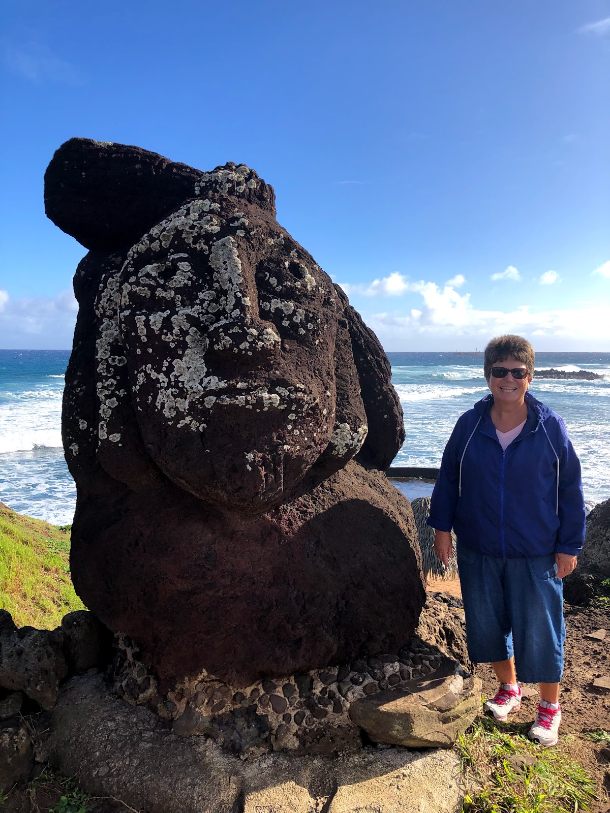
We also visited Puna Pau, an inland volcanic site.  The red colored rocks found in this area were used to carve the topknot (hats) that were placed on the moai once they had been moved to their final location.  Like the moai, these stones were huge, often weighing up to 10 tons.  I've heard of Texans and their 10 gallon cowboy hats.  Here we have the moai and their ten ton topknots!
A couple of pictures from Pana Pau.  This is where the topknots (hats) for the moai were carved from the red volcanic rock.

Some of the topknots had petroglyphs carved in them

Our last destination was Ahu Akivi.  This platform was composed of seven moai.  Although large, they were smaller than many of the moai we had seen in other locations.  They also gave the appearance of being carved in the likeness of younger men.  These moai are the ones I referred to previously that face out to sea.  It was believed they were honoring and looking after young explorers and their journeys on the sea.  They were positioned astronomically so that they are facing directly to sunset during the spring equinox, and their backs directly to sunrise on the autumn equinox.  For those of you who are like me and didn't know or remember what the equinox is, this is when the center of the visible sun is directly above the equator.
The seven moai of Ahu Akivi staring out to sea


Thursday, June 20, 2019

Easter Island Day 2-Moai, Moai and more Moai..........

The two newest members of the moai family!

There is certainly a lot more to Easter Island than just the moai.  But, it's hard to ignore the close to 1,000 statues, averaging over 30 feet in height and weighing more than 50,000 pounds, that are scattered about the island.  There is so much mystery surrounding them, some of the basic questions are; Why were they carved?  How were they transported, sometimes miles away over rough hilly terrain? Why were they all toppled and who toppled them?  There are commonly supported answers to all the questions, but without the benefit of written or oral documentation, they all remain "educated guesses".
Yesterday we did a six hour tour of the island that featured stops at some of the most famous locations of moai, as well as the quarry where they were carved.  Our tour guide was Peter, the owner of the Hareswiss, where we are staying.  Although he is originally from Switzerland, he has lived on the island a number of years and has a great deal of knowledge about all things Easter Island, as well as about American movies and music!
The completed moai were transported from the quarry to what are known as "ahu" or platforms along the coast.  Probably the easiest way to describe an "ahu" is like a huge outdoor ceremonial alter constructed of stones.  As a general rule the moai were placed looking inward toward the land.  A common belief is that they were built honoring past leaders/elders of the various tribes or klans that inhabited the island.  They face inland to be watching over and providing protection to the land and it's people.  There are two noted exceptions to the moai facing inland.  One is the quarry where they were carved (more on this later) and the other is a series of seven moai facing out to sea as if to be guiding weary travelers in small boats to shore.
Our first stop was at a beautiful location on the coast with huge waves of blue water crashing over the lava rocks.  There was a platform with several moai that had not been restored to their upright position.  Some were lying face down while others were face up.  One of the long term concerns is the continued gradual deterioration of the moai due to the elements and small plants called lichens.  Ironically, the moai lying face down are provided with some protection and the facial features are deteriorating at a much slower rate.

Kind of like me, this guy has had a little too much sun exposure over the years

Time and the elements of nature have taken it's toll on this moai

From there we made our way to "Rano Raraku", the quarry, where these massive statues were carved.  The moai were carved from single pieces of stone.  They were carved while in a laying position.  It was believed that each moai had a "master carver" who oversaw the work of teams.  It is also thought that it took up to two years to complete one moai.  Once the front of the moai was completed they were carefully lifted into an upright position and slid down the hillside into an awaiting hole.  Once secured in the hole the backside would be completed and the moai would be transported to it's appropriate location, where it would be placed upright and facing inland.
As you can imagine, the carving and transporting of these was no easy task!  It is believed they were transported either by some type of sled or gradually tipping and walking them forward inch by inch.  Either way, it required a lot of time, skill and effort by a lot of people!
The moai in this and the next three pictures were either completed and awaiting transport or near completion when the work ceased (probably due to tribal wars).  They had been carved lying down and slid down the mountain into a hole where the finishing touches could be done on the back.  Only about 1/3 of the total size of the statue is visible.


According to Peter, there are 397 moai remaining at the quarry.  As he put it, "it was like they left work on a Monday and didn't return on Tuesday".  Many of them appear to have been completed and awaiting transportation, while others were in the early stages.  It is also thought that in addition to the ones visible, that there are likely a large number that over the years were slowly covered with soil and grass. It was very surreal to walk through the quarry and imagine what it must of looked like on a busy day.
This moai was in the early stages of carving when work ceased.

Our final stop was at Tongariki, the largest ceremonial platform on Easter Island.  This platform is located less than a mile from the quarry.  Here there are fifteen moai that have been restored to their upright position, including one that weighed over 172,000 pounds (the largest known one on the island).  Most, if not all the moai on the island were believed to have been toppled during island tribal wars as a way of demoralizing the other tribes, or by explorers visiting the islands.  These particular moai were later swept inland by a massive tsunami that hit the island in the twentieth century, making the restoration project even more challenging and impressive to see.
Tongariki from a distance.  After being toppled, these were later swept inland by a tsunami.  


I had to get a picture of this old VW microbus that's been converted into a "snack shack"

After a little rest, we finished the day with a walk down to the waters edge to enjoy a beautiful sunset.  It's too bad that the moai between us and the sunset were facing inland, they missed a nice show!

The crowd gathering for sunset

They're missing a nice show!

All the original moai were believed to have eyes made of coral.  The coral was not placed in the eye sockets until the moai were transported and erected in their appropriate location.  The coral deteriorated much faster than the stone.  This one has had the eyes replaced to show what it might have looked like after completion.


Wednesday, June 19, 2019

Easter Island-Day 1

Moai along the waterfront in the town of Hanga Roa.

Good Morning from one of the most remote inhabited places on the planet!  It's Wednesday morning and the current time here on the island is around 5:45 AM (we're on Mountain Standard Time).  We arrived around 11:00 PM on Monday night.  As we kept flying and flying, I was trying to imagine the challenges the first inhabitants to the island faced in reaching it.  Suddenly that airplane seat didn't feel quite so cramped!
The view from our bungalow at Hareswiss

One interesting thing that we learned as we looked about the peaceful town of Hanga Roa (the only "town" on the island), is that because the island is so remote, there isn't much solid evidence of when the first humans arrived.  One source (a book by a historian) gave a range of between 600 and 900 AD, while the museum gave the dates as between 800 and 1200 AD.  One fact that is certain is that the island was discovered by the outside world on April 5, 1722 by the Dutch explorer Jacob Roggeveen.  That day happened to be Easter Sunday, hence the name Easter Island.  History shows the early inhabitants called the island Rapa Nui.  The name of choice by the locals continues to be Rapa Nui.
When Roggeveen arrived he found the island to be mostly barren of palm trees.  It was originally believed that the first settlers had over harvested to obtain building material and to clear the land for farming.  Later on it was proven that the lack of trees was most likely a combination of over harvesting and a huge mice infestation.  The main source of food for the mice was seeds from the trees.  They consumed so many that new trees could not germinate and grow to replace the ones that had been cut down.  Today, the island is lush and green with many tropical trees, banana plants and colorful flowers.  The island has a very Polynesian feel to it, which it should have.  It along with New Zealand and Hawaii make up the Polynesian Triangle.
We're staying at the Hareswiss, which is owned by a nice gentleman named Peter who is originally from Switzerland.  His wife (Tiare) is a native of the island.  She is a flight attendant for Latam Airlines.  We haven't had the chance to meet her or their two young daughters yet, but I'm sure we will in the coming days.
Yesterday was a pretty relaxing day.  It gave us time to recover from the long travel day on Monday and to get oriented to the area.  Peter drove us the short distance into town and gave us a brief tour as well as some recommendations on the important things such as what to see and where to eat.  After a quick stop at a small local market to pick up some essentials (water and wine), which he kindly carried back to the bungalow, he dropped us off to do some exploring on our own.  We purchased our required National Park pass ($80 US per person for non-Chilean visitors).  The pass is good for ten days and is essential since much of the island and historical sites are within the national park.
The town has two main streets, one along the waterfront and another that runs parallel to it.  Most of the restaurants and shops are along these streets or the connecting roads between them.  We enjoyed the waterfront and taking in views of our first moai, the statues that have made Easter Island so famous.  There will be plenty of pictures of  different moai in the coming days.  Here are a few...…...


Along the waterfront.  The town of Hanga Roa is in the background

Main Street in Hanga Roa

There are a number of well cared for and friendly dogs wandering around town.  This girl joined us for a bit of our walk and relaxed with us along the waterfront.

A man, a bench and the Pacific Ocean

Beth and her new friend

A very nice park in the center of town

The new public library that opened earlier this year.  The staff were proud to show it off.  They encouraged us to look around both the first floor (library) and the second floor (public meeting space)

We enjoyed some great empanada's at a small restaurant named Empanadas Tia Berta.  Our server proudly told us they were the top rated empanadas on the island.  At this point we have no reason to doubt him.  They were huge and very tasty.
Afterwards we visited the small, but very interesting, museum that told the story of the history of the island as best as it could.  The museum made the disclaimer right at the start that much of the early history was speculation.  Many times it would give different theories such as when the first inhabitants arrived, where they came from, the purpose of the moai and how the heck they moved these huge statues from the quarry in the middle of the island to their locations near the waterfront.
Horses were grazing freely in open spaces near the waterfront trail


A couple of artifacts inside the museum...…...


I'll have plenty of information to share over the next week as we continue to explore and learn about this mysterious, colorful island in the middle of the Pacific Ocean.   

Tuesday, June 18, 2019

San Pedro de Atacama-Day 6 Wrapping it up

Beth and I with our favorite host...…...Kate

It's now Tuesday morning.  We woke up this morning to a steady breeze rustling through the trees and a view of the Pacific Ocean.  Yesterday was a travel day and the contrast in the locations couldn't be much greater.  From a vast desert to a small island 2,339 miles out in the Pacific Ocean.  There'll be plenty on Easter Island in the coming days.  This blog is about wrapping up our time in San Pedro de Atacama.
Our final morning we were greeted to the same wonderful smile from Carla.  Her fresh coffee, tea and breakfast spread had us pretty spoiled.  Kate joined us around 8:00, just as she promised, to say goodbye and offer a final suggestion for our morning as we made our way back to the Calama airport.  After a few pictures and hugs we were on our way.
Carla always greeted us with a huge smile and a great breakfast 

With a couple of extra hours time on our hands we made a slight detour off Route 23 to the Valle del Arcoiris,  which is also known as Rainbow Valley.  It's a valley that has earned it's name, as there were rocks of multiple shades of red, green, yellow and white under the blue sky.  It was well worth the visit and left us just enough time for a quick stop at the very modern Jumbo Supermarket to pick up a few food items to bring on the next leg of the journey.


That's the Chilean version of the Rio Grande!

We absolutely loved our time in San Pedro de Atacama.  If somewhere down the road it's a destination of yours, here are just a couple of suggestions you might find helpful.
Rent a car!   Juan, the owner of the Planeta Atacama kept encouraging us to rent a car instead of depending on airport transfers and guided tours.  We can't thank him enough for his insistence.  Driving was easy, it saved us a ton of money and we were able to do things on our on time.  Many of the rentals were 4 wheel drive vehicles (much more expensive).  For our needs, the small car worked just fine, even on the bumpy, unpaved roads that we often traveled.
If you do rent a car, it will probably be a manual transmission.  Also note, at the present time there is only one gas station in San Pedro de Atacama and many of the surrounding villages do not have gas.  Although we never ventured more than around 75 miles away, we kept the gas tank close to full.
With a GPS (I used google maps on my phone), you'll do just fine.
There are numerous hotels and hostels in the San Pedro de Atacama area ranging in price from insanely expensive to inexpensive.  The Planeta Atacama was perfect for our needs.  It is located less than a mile from the city center.  That means it is quieter, but easy to get to the many shops, restaurants and tour companies.  The views out our room and from the terrace were incredible and the hospitality of Kate and Carla was exceptional.  If we ever return to the area, I couldn't imagine staying anywhere else.
We ate at a couple of places that I had mentioned in previous blogs. The food was very good at all of them.  TripAdvisor, Yelp or your host will be very helpful.  Please note that while some restaurants take credit cards, many of them are "cash only".  Food prices were moderate to a little high.  I would highly recommend stopping by one of the supermarkets in Calama.  The Jumbo Supermarket was huge (very similar in size to a Super Wal-Mart, just not as many "interesting" looking people), with a wide variety of both fresh and packaged foods.  You'll need plenty of bottled water!
The bakery section of the Super Jumbo

We used the ATM at the Santiago airport to get Chilean pesos.  I did see several ATM's in San Pedro de Atacama. The current exchange rate is 1,000 pesos = approximately $1.40 US.
Right now it is the "off season" in the Atacama Desert region.  That means the rates are less, there are fewer people and the temperatures are cooler.  We don't find anything wrong with any of those three things.  One thing that you may want to be aware of is the winter road conditions.  According to Kate, they do not have snow removal equipment.  If it snows at the higher elevations some of the roads may be closed.  We had one issue with this so we simply changed our plans for the day to a couple of other activities.
Speaking of activities, there is plenty to keep you busy for at least a week.  Give yourself as much time as possible, you won't regret it!